Synopsis:
A strong Bermuda high pressure system will put the region into a deep into a Southwest flow today through Sunday. This will result in a hot and tropical airmass. A heat wave is expected. Temperatures in the 90s combined with the high humidity will translate into a heat index of 97º-105º+ through the weekend. The heat will peak on Saturday. The threat of afternoon storms will be spotty in nature. Much of the time will be dry. Yes, August’s unpleasant side will be with us for some time.
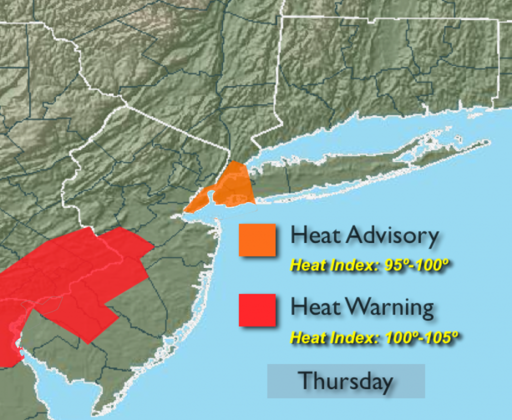
Today:
Hazy, hot and humid. A spotty afternoon storm is possible. Highs around 90º. Heat Index of 97º-103º. Southwest wind at 10-15mph.
Tonight:
Mostly cloudy with an isolated storm early. Muggy and warm with lows in the 70s throughout. Southwest wind at 5mph.
Friday:
Hazy, hot and humid with spotty PM storms. Highs in the lower 90s. Heat index of 100º-105º.
Saturday:
A Sizzling Saturday. Hazy and humid with spotty PM Storms. Highs in the mid 90s. Heat index of 100º-108º.
Sunday:
Hazy, hot and humid with scattered PM thunderstorms. Highs in the lower 90s. Heat index of 100º-105º.
Monday:
The heat wave will break. Showers and storms are likely with highs in the mid 80s.
Stay Tuned.
Keep it here for a no nonsense, no hype forecast.