Synopsis:
High pressure over the Southeast will continue to provide hot temperatures through the weekend and into next week. A heat wave is under way and is expected to last another five days. The humidity won’t be much of a factor as it will be low. The humidity will be much higher on Monday. For this reason an Excessive Heat Watch is in effect for New York City Monday as the Heat Index will approach 105º. A Heat Advisory is in effect for the rest of the Tri-State area for Monday for a Heat Index of 100º-105º.
Little in the way of relief is expected from thunderstorms. A trough (weak front) will move in later tonight and then again later Monday afternoon with a chance of scattered storms.
Today:
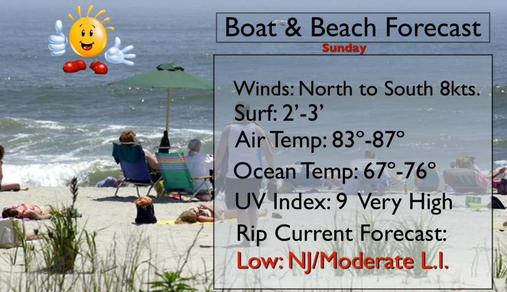
Mostly sunny and hot with low levels of humidity. Highs will be in the lower 90s. North wind will become South at 8-12mph.
Tonight:
Mostly cloudy and becoming humid. Scattered thunderstorms are possible after midnight. Lows in the upper 70s to around 80º in City, the upper 60s to 70s inland. Winds Southwest at 5mph.
Monday:
Oppressive with highs well into the 90s. Heat index will be 100º-107º. Hazy with the chance of scattered late afternoon storms.
Tuesday:
Mostly sunny. Highs will be in the lower to mid 90s. Heat index will be 95º-100º.
Wednesday:
Hot. Mostly Sunny with readings in the lower 90s.
Thursday:
The heat wave continues. Partly sunny with highs around 90º.
Keep it here for a no nonsense, no hype forecast.