Synopsis:
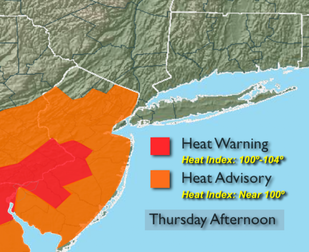
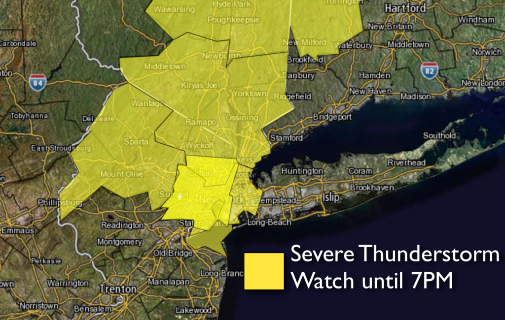
***SEVERE THUNDERSTORM WATCH UNTIL 7PM***A tropical airmass has moved into the tri-state area with a Southerly flow. Hot and very humid air will grip the region today. Heat Advisories and Warnings have been posted for New Jersey. The combination of the heat and high humidity will make it feel like 100º or higher. Keep an eye to the sky for threatening weather after 2pm. Scattered thunderstorms will develop. The storms could be severe. The best chance will be North of the city. The heat will peak on Friday with very warm and dry conditions continuing into the weekend.
Today:
The 3 H’s are back. Any morning fog will burn off leaving a mix of clouds and sun. Temperatures will be in the 80s to around 90º. It’ll be cooler at the coast. Heat index will range from near 95º over Eastern areas to around 100º+ inland. Scattered strong to severe thunderstorms will develop after 2pm. The best chance will be North of the City. South wind at 10-20mph with higher gusts.
Tonight:
Mostly cloudy and muggy with widely scattered storms. Lows in the mid to upper 70s in the city, the upper 60s to near 70º inland. Southwest to West wind at 5-10mph.
Friday:
Hot. Becoming less humid during the day. Highs in the lower to mid 90s.
Saturday:
Partly sunny, very warm, but not as humid. Highs in the upper 80s.
Sunday:
Partly sunny and very warm. Highs once again the upper 80s.
Monday:
Hot and humid with scattered afternoon storms. Highs around 90º.
Keep it here for a no nonsense, no hype forecast.