Synopsis:
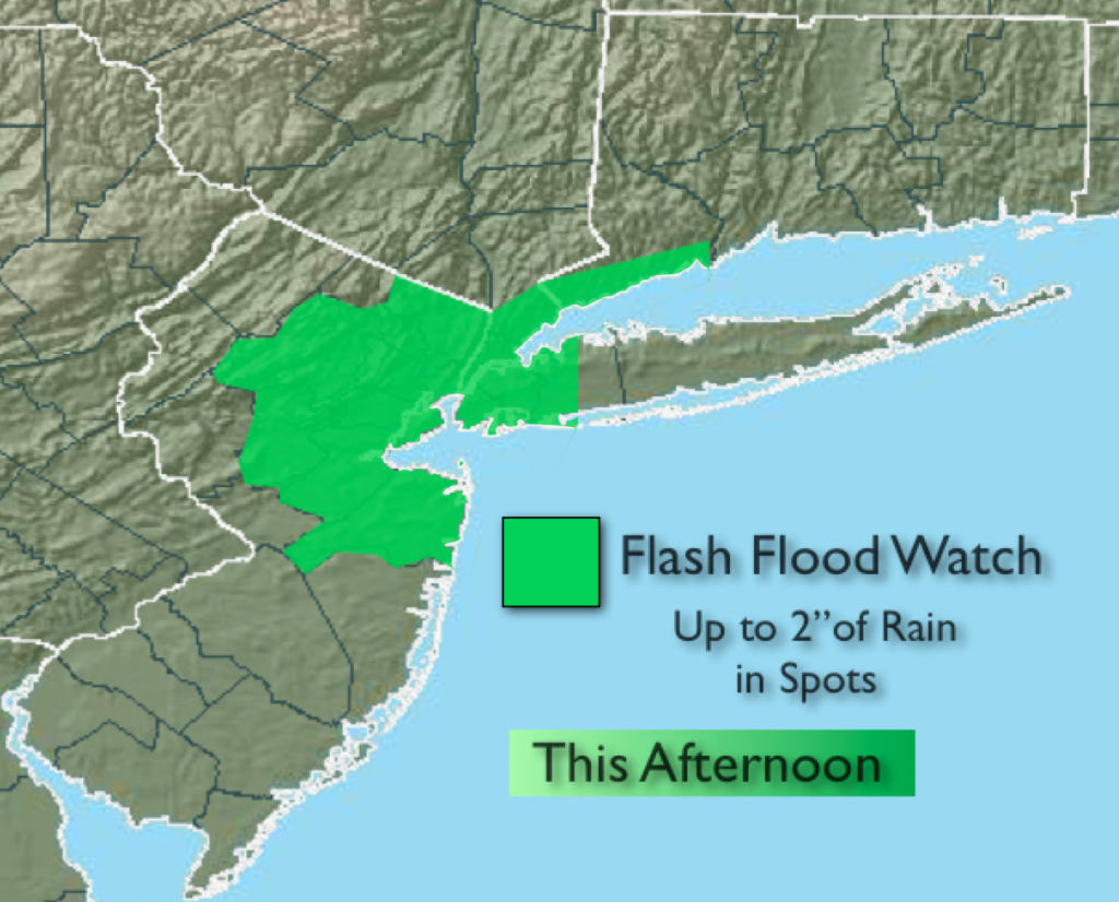
A flash flood watch is in effect for this afternoon for the immediate metro area. Any scattered thunderstorms that develop this afternoon have the capability of producing torrential rain, up to two inches, in a short period of time. This could lead to flash flooding. Never drive through a flooded roadway, you can’t judge just how deep the water is. TURN AROUND, DON’T DROWN. Not all areas will receive the drenching thunderstorms. Keep an eye to the sky after 2pm today.
The heat wave will continue through Saturday. Unfortunately the humidity levels will continue to increase. Please use caution as this is our first heat wave of the season and we are not accustom to these temperatures.
Today:
A sizzler. Hazy, hot and humid with highs in the lower 90s. Scattered afternoon storms are possible. Heat index will be 95-100º. Southwest wind at 8-12mph.
Tonight:
An evening thunderstorm, otherwise partly cloudy and muggy. Lows in the mid 70s in the City, the upper 60s inland. Light and variable winds.
Friday:
The heat will peak with readings in the lower to mid 90s under hazy skies. The heat index will be between 100º-105º. An isolated storm is possible.
Saturday:
Sultry with highs around 90º. Scattered morning storms are possible.
Sunday:
The heat wave breaks with highs in the mid 80s with much lower humidity.
Monday:
A July gem. Sunny and warm with low humidity. Highs in the mid 80s.
Keep it here for a no nonsense, no hype forecast.