Heat Continues. Some Relief Friday…


Synopsis:

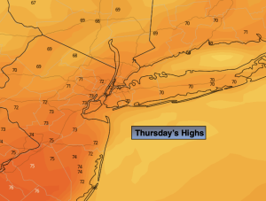
It’ll be another scorcher today. Readings will reach the highest temperatures recorded all Summer long at 93º. The temperature hit 93º yesterday at Central Park. A similar reading is expected today. Hazy sunshine and humid conditions are in the forecast.

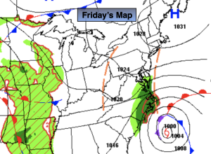
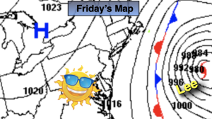
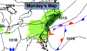
The bubble of heat over our region will break down on Friday. This should keep temperatures below the 90º mark. At the same time a weakening front will approach from the West. The threat of late day and evening storms are in the forecast although the latest guidance has most areas dry. A higher threat of showers and storms are likely on Saturday and Sunday as the disturbance stalls over the region and weakens. This weekend will not be a washout. There will be more clouds than sun but an all day rain is not expected. It’ll be humid through the weekend as a Southerly flow continues.

Stay tuned.

Keep it here for a no nonsense, no hype forecast.

Thursday:

Hazy, hot and humid. Highs in the lower to mid 90s. Cooler at the coast. West to South winds at 5-10mph.

Tonight:

Partly cloudy. An isolated shower or storm possible. Most areas will remain dry. Lows in the mid 70s in the City, the 60s inland. Light South winds.

Friday:

Partly sunny. Not as hot. Humid. Late day or evening shower or storm possible. Highs in the mid 80s.

Saturday:

Mostly cloudy. Scattered showers and storms possible. Highs in the lower 80s.

Sunday:

Mostly cloudy. Scattered showers. Highs around 80º.

Monday:

Mostly cloudy. Scattered showers. Highs around 80º.

July-Like Heat Wednesday…


Synopsis:

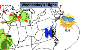
Today will feel every bit like July as temperatures soar and humidity levels remains high. This is all courtesy of a bubble of hot air over the region and an upper level high anchored over the East. Summer doesn’t want to let go! A Heat Advisory continues for many areas. High temperatures and high humidity will make it feel like the mid to upper 90s. Some record high temperatures are possible. If the temperature hits 94º in the City it will be the hottest day this Summer. That’s quite unusual for that to possibly occur six days into September.

The heat will break as high pressure weakens and moves offshore by Friday. At this time a front will approach from the West. The threat of late day and evening storms are in the forecast although the latest guidance has it mainly dry. More numerous showers and storms are likely on Saturday and Sunday as the front stalls over the region.

Stay tuned.

Keep it here for a no nonsense, no hype forecast.

Wednesday:

Mostly sunny. Hot. Highs in the mid 90s. Cooler at the coast. Northwest winds at 5mph.

Tonight:

Mostly clear and warm. Lows in the mid 70s in the City, the 60s inland. Light Southwest winds.

Thursday:

Partly sunny. Hot. Highs around 90º.

Friday:

Partly sunny. Not as hot. Late day or evening shower or storm possible. Highs in the mid 80s.

Saturday:

Mostly cloudy. Scattered showers and storms possible. Highs in the lower 80s.

Sunday:

Mostly cloudy. Scattered showers. Highs around 80º.

Heat Continues Heading Back to School & Work…


Synopsis:

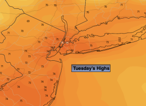
Back to work and school on today through Thursday will feature more of the same as high pressure remains anchored over the East. Summer doesn’t want to let go! A Heat Advisory has been issued for many areas. High temperatures and high humidity will make it feel like the mid to upper 90s. This isn’t unheard for September. The funny thing is it’s warmer now than its been on any day in August.

The heat will break as high pressure weakens and moves offshore by Friday. At this time a front will approach from the West. The threat of late day and evening storms are in the forecast. More numerous showers and storms are likely on Saturday as the front stalls over the region.

Stay tuned.

Keep it here for a no nonsense, no hype forecast.

Tuesday:

Sun and clouds. Hot. Highs in the upper 80s to lower 90s. Cooler at the coast. North winds 5-10mph.

Tonight:

Mostly clear and warm. Lows in the mid 70s in the City, the 60s inland. Light Northwest winds.

Wednesday:

Mostly sunny. Hot. Highs in the upper 80s to lower 90s.

Thursday:

Partly sunny. Hot. Highs around 90º.

Friday:

Partly sunny. Not as hot. Late day showers or storms possible. Highs in the mid 80s.

Saturday:

Mostly cloudy. Showers and storms possible. Highs in the lower 80s.

Spectacular Saturday…


Synopsis:

The entire Labor Day Weekend will be sunny with temperatures rising each day as high pressure becomes a warm weather maker. By the holiday many areas will be flirting with 90º. This Labor Day Weekend will be a memorable one for sure. Enjoy!

Back to work and school on Tuesday and Wednesday will feature more of the same as high pressure remains anchored over the East. Summer doesn’t want to let go!

Stay tuned.

Keep it here for a no nonsense, no hype forecast.

Saturday:

Sunny. Highs around 80º. Winds becoming South to Southwest at 8-12mph.

Tonight:

Clear. Lows in the mid to upper 60s along the coast the 50s and lower 60s inland. Light Southwest winds.

Sunday:

Sunny. Warmer. Highs in the mid to upper 80s.

Labor Day:

Mostly sunny. Hot. Highs around 90º.

Tuesday:

Mostly sunny. Hot. Highs around 90º.

Wednesday:

Mostly sunny. Hot. Highs around 90º.

September’s Debut-A Winner…


Synopsis:

September’s debut will refreshingly cool as high pressure originating in Canada moves over the Northeast. Readings today will be a several degrees below the average high of the lower 80s. We’ll experience some great sleeping weather as well. Readings inland tonight will once again dip into the 40s in spots!

The entire Labor Day Weekend will be sunny with temperatures rising each day as high pressure becomes a warm weather maker. By the holiday many areas will be flirting with 90º. This Labor Day Weekend will be a memorable one for sure. Enjoy!

Back to work and school on Tuesday will feature more of the same as high pressure remains anchored over the East.

Stay tuned.

Keep it here for a no nonsense, no hype forecast.

Friday:

Sunny. Highs in the mid 70s. Northeast to Southeast winds at 5-10mph.

Tonight:

Clear and cool. Lows in the lower 60s along the coast the 40s & 50s inland. Light Southwest winds.

Saturday:

Sunny. Highs around 80º.

Sunday:

Sunny. Warmer. Highs in the mid 80s.

Labor Day:

Sunny. Hot. Highs around 90º.

Tuesday:

Mostly sunny. Hot. Highs around 90º.

Refreshing Breeze. Mainly Sunny…


Synopsis:

Get ready for a string of beautiful days as we close out August and welcome September on Friday. High pressure to our Northwest will supply the region with a Canadian airmass. Readings today and Friday will be a few degrees below the average high of the lower 80s. We’ll experience some great sleeping weather as well. Readings inland tonight will dip into the 40s. Give that AC a break!

The entire Labor Day Weekend will be sunny with temperatures rising each day. By the holiday many areas will be flirting with 90º. This Labor Day Weekend will be a memorable one for sure. Enjoy!

Stay tuned.

Keep it here for a no nonsense, no hype forecast.

Thursday:

Mostly sunny, cooler. Much less humid.  Highs in the upper 70s. North to Northeast winds at 10-15mph.

Tonight:

Clear and cool. Lows near 60º along the coast the 40s & 50s inland. North to Northeast winds at 5mph.

Friday:

Sunny. Highs in the upper 70s.

Saturday:

Sunny. Highs around 80º.

Sunday:

Sunny. Warmer. Highs in the mid 80s.

Labor Day:

Sunny. Hot. Highs around 90º.

AM Showers to Sun. Warm. Becoming Less Humid…


Synopsis:

Scattered showers will occur this morning as a weak cool front bumps into our humid airmass. The showers will be short-lived as the system moves rapidly offshore. The sun will return by midday and the afternoon will be mainly sunny and warm with lowering levels of humidity.

The end of the week looks delightful with bright, refreshing conditions as strong high pressure moves in. A delightful start to the month of September and the Labor Day Weekend.  In fact the entire Labor Day Weekend will be sunny and warm with high pressure anchored over the Northeast. Enjoy!

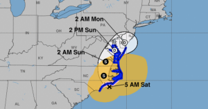
Hurricane Idalia has made landfall in big bend area of Florida as a major hurricane (tracking maps are above). The storm will move over Georgia and the Carolinas through Thursday. Our area will only experience rough surf and rip currents.

Stay tuned.

Keep it here for a no nonsense, no hype forecast.

Wednesday:

Scattered morning showers, humid. Afternoon sun with lowering humidity. Warm. Highs in the lower to mid 80s. Winds becoming Northwest at 8-12mph.

Tonight:

Partly cloudy. Less Humid. Lows in the mid 60s along the coast the 50s inland. Northwest winds at 10-15mph.

Thursday:

Mostly sunny, cooler. Much less humid.  Highs in the upper 70s.

Friday:

Sunny. Highs in the upper 70s.

Saturday:

Sunny. Highs around 80º.

Sunday:

Sunny. Warmer. Highs in the mid 80s.

Sun & Clouds. Spot Coastal Shower…


Synopsis:

A weak offshore frontal boundary will affect our weather today. A mix of clouds and sun is expected. Spotty showers are possible, mainly by the coast. Readings will be a few degrees below the average high of the lower 80s.

Scattered showers are in the forecast for tonight and Wednesday morning as a weak cool front bumps into our humid airmass. By Wednesday afternoon the sun should dominate the sky and it’ll be warm with lowering humidity levels.

The end of the week looks delightful with abundant sunshine and refreshing conditions as strong high pressure moves in. A delightful start to the month of September and the Labor Day Weekend.

It’s double trouble in the tropics. Hurricane Franklin will be moving between the the US mainland and Bermuda through Wednesday. Hurricane Idalia will be making landfall along the big bend area of Florida sometime Wednesday morning as a major hurricane (tracking maps are above). Our area will only experience rough surf and rip currents from these storms.

Stay tuned.

Keep it here for a no nonsense, no hype forecast.

Tuesday:

Sun and clouds. Humid. Scattered showers possible, mainly at the coast. Highs in the upper 70s to around 80º inland. East winds at 5-10mph.

Tonight:

Mostly cloudy. Scattered showers possible. Lows in the lower 70s along the coast the upper 60s inland. Southeast winds at 5mph.

Wednesday:

Scattered morning showers possible, humid. Afternoon sun with lowering humidity. Highs in the lower 80s.

Thursday:

Mostly sunny, cooler. Much less humid.  Highs in the upper 70s.

Friday:

Sunny. Highs in the upper 70s.

Saturday:

Sunny. Highs around 80º.

More Clouds Than Sun to Start the Week…


Synopsis:

A weak offshore frontal boundary will affect our weather the next coupe of days. Today will feature a mix of clouds and sun. It’ll remain dry with readings a few degrees below the average high of the lower 80s.

Tuesday and Wednesday will be humid with clouds dominating. Showers are likely just about anytime as the frontal boundary gets pushed up into the region from the Southeast. It will not be a washout.

Hurricane Franklin will be moving between the the US mainland and Bermuda and what will be Hurricane Idalia will be making landfall along the big bend area of Florida (maps above). Tropical air tends to get thrown our way when systems are to our Southeast. Our area will only experience rough surf and rip currents from these storms.

The end of the week looks delightful with abundant sunshine and refreshing conditions as strong high pressure moves in.

Stay tuned.

Keep it here for a no nonsense, no hype forecast.

Monday:

Clouds and sun. Highs in the upper 70s. Southeast winds at 5-10mph.

Tonight:

Mostly cloudy. Scattered showers possible, mainly by the coast. Lows in the 60s throughout. Southeast to Northeast winds at 5mph.

Tuesday:

Mostly cloudy. Humid. Scattered showers possible. Highs in the mid to upper 70s.

Wednesday:

Mostly cloudy. Humid. Scattered showers possible. Highs near 80º

Thursday:

Mostly sunny, cooler. Much less humid.  Highs in the mid 70s.

Friday:

Mostly sunny. Highs in the mid 70s.

Spot AM Shower. Clouds to Sun Saturday. Warm…


Synopsis:

A weak front will clear the coast during the morning. A batch of showers in the immediate NYC vicinity will move East and dissipate. Any clouds will give way to mostly sunny skies this morning and afternoon. It’ll be warm and moderately humid. Sunday will be the more comfortable day of the weekend with humidity levels coming way down. High pressure nosing in from Eastern Canada will be responsible for our delightful weather.

The beginning of the week looks fabulous with bright skies and low humidity. The next threat of showers will be on Wednesday with an approaching front.

Stay tuned.

Keep it here for a no nonsense, no hype forecast.

Saturday:

Early morning scattered showers in the NYC vicinity, otherwise becoming mostly sunny. Warm. Highs in the mid 80s. North winds at 5-10mph.

Tonight:

Mostly clear. More comfortable. Lows in the mid to upper 60s in the City, around 60º inland. North winds at 5mph.

Sunday:

Mostly sunny. Much lower humidity. Highs in the upper 70s.

Monday:

Partly sunny. Highs in the mid to upper 70s.

Tuesday:

Partly sunny. Highs in the mid to upper 70s.

Wednesday:

Mostly cloudy. Scattered showers possible. Highs near 80º