Synopsis:
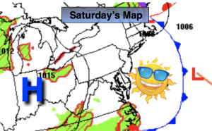
Our fine late July conditions will spill into the beginning of August. It’ll be a refreshing and the forecast won’t change much though Thursday. High pressure originating in Canada is the one to thank for our fab mid Summer weather. Abundant sunshine and low humidity will rule.
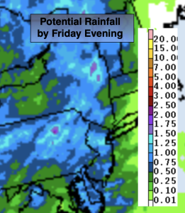
By Friday, a warm front will push through our region. Scattered showers are possible.
Stay tuned.
Keep it here for a no nonsense, no hype forecast.
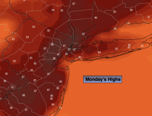
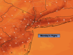
Monday:
Mostly sunny. Highs in the lower 80s. Northwest winds at 5-10mph.
Tonight:
Mostly clear and comfortable. Lows in the mid 60s along the urban corridor, the 50s inland. Northwest winds at 5-10mph.
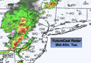
Tuesday:
Sunny. Cooler. Highs in the upper 70s.
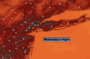
Wednesday:
Sunny. Highs in the upper 70s.
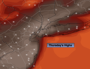
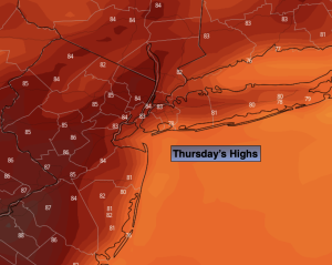
Thursday:
Partly sunny. Highs in the lower 80s.
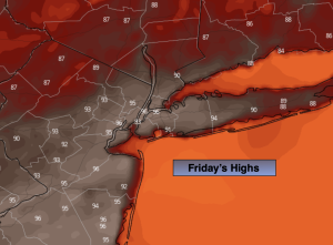
Friday:
Sun and clouds. Scattered showers possible. Highs in the lower 80s.