Synopsis:
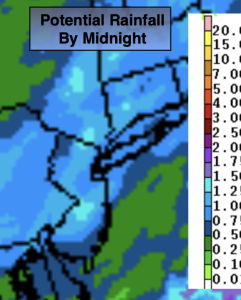
A disturbance will approach the area from the West today. Any sunshine will give way to scattered showers around midday. Rain should become more widespread and locally heavy by mid-afternoon. A few storms are possible. The potential is there for over an inch of rain by the time the system moves offshore this evening.
Friday and the weekend look like fine mid-August days with abundant sunshine and warm temperatures. Weak high pressure well off the coast will be responsible for our smiles!
Stay tuned.
Keep it here for a no nonsense, no hype forecast.
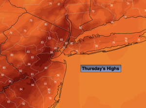
Thursday:
Morning sun will give way to afternoon showers and storms. There will be areas of heavy rain. Highs in the upper 70s to around 80º. South winds at 8-12mph with gusts to 20mph.
Tonight:
Scattered showers and storms ending this evening. Becoming mostly clear. Lows in the 60s throughout. Southwest to West winds at 8-12mph with gusts to 20mph.
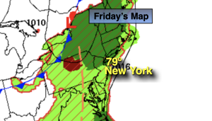
Friday:
Sunny. Highs in the mid 80s.
Saturday:
Mostly sunny. Highs in the mid 80s.
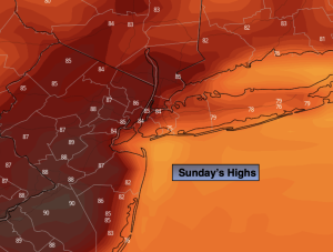
Sunday:
Partly sunny. Highs in the upper 80s.
Monday:
Partly sunny. Highs in the mid 80s.