Synopsis:
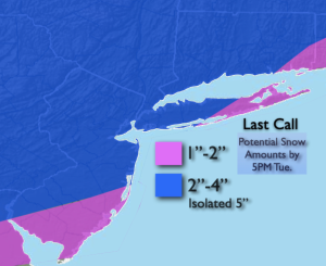
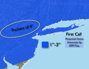
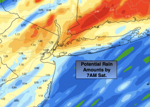
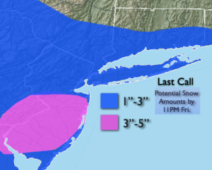
The storm that gave areas to the North scattered light snow and areas to the South heavier snow is moving well out to sea. The snow will continue to taper off over Southern areas this evening. The forecast snow amounts panned out quite nicely.
An Arctic blast will arrive tonight on gusty Northwest winds as strong high pressure to the West begins to build in. Wind chills by morning will be near zero inland and in the single digits at the coast.
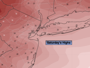
Saturday will be frigid despite plenty sunshine. The wind will add a bite as winds chills will remain in the teens along the coast to around 10º well inland.
Sunday readings under sunny skies will remain below freezing.
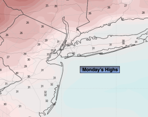
We’ll be out of the freezer on Monday as the high moves off the coast and a milder flow takes hold.
Tuesday will feel like a heatwave as we getting into the 40s!
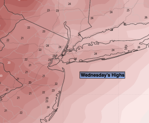
It’ll be mild on Wednesday with scattered showers as a disturbance moves in from the West.
Keep it here for a no nonsense, no hype forecast.
Tonight:
Becoming mostly clear, breezy and much colder. Lows in the upper teens along the urban corridor, the lower to mid teens inland. Northwest winds at 10-20mph with gusts to 25mph. Wind chills in the single digits to near zero inland.
Saturday:
Partly sunny, breezy and frigid. Highs in the 20s. Northwest winds at 15-25mph with gusts to 30mph. Wind chills in the teens.
Sunday:
Sunny. Highs around 30º
Monday:
Sunny. Highs in the upper 30s.
Tuesday:
Sun to clouds. Mild. Highs in the mid 40s.
Wednesday:
Mostly cloudy. Scattered showers. Highs in the mid 40s.