Synopsis
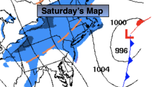
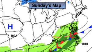
The Spring feel will continue through the weekend. A washed out front will work through today. More clouds than sun is expected. A few showers are possible in the afternoon. Super Bowl Sunday will be dry and mild with more sun than clouds.
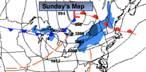
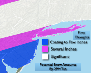
Clouds will roll in on Monday ahead of a developing system over the central Appalachians. This low will redevelop East of Delaware Tuesday and then move up and off the coast. Rain will develop Monday night. Inland a mix will change to snow. As the storm intensifies rapidly off our coast colder air will be wrapped into the system both from aloft and at the surface. The potential has increased for the rain to go over to accumulating snow in the NYC vicinity by Tuesday morning. Heavy snow may fall for a time. Central and Southern NJ will be the last to change over to snow on Tuesday. The snow will taper off around midday.
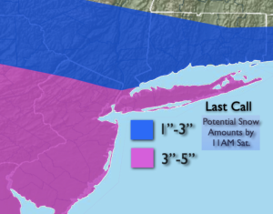
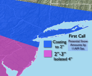
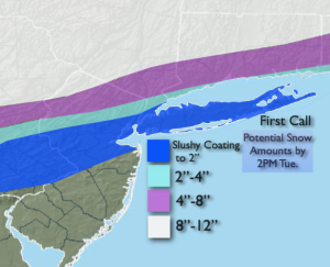
The “first thoughts” map on potential snow amounts is above. A good chunk of the region has the potential to receive a plowable snowfall. This map will obviously change as the event is still a couple of days away. With that said, the computer guidance in fairly good agreement now on the strength and track of the low.
As the storm pulls away Tuesday afternoon the sun may shine for a couple of hours.
A blustery day is anticipated for Wednesday, Valentines Day. Skies will be partly sunny with near seasonable temperatures.
Stay tuned.
Keep it here for a no nonsense, no hype forecast.
Saturday:
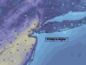
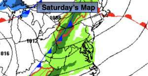
Mostly cloudy. Threat of afternoon showers. Very mild. Highs around 60º. West winds at 5-10mph.
Tonight:
Mostly cloudy. Mild. Lows in the mid 40s in the City, the upper 30s & 40s inland. West to Northwest winds at 5mph.
Sunday:
Partly sunny. Mild. Highs in the lower 50s.
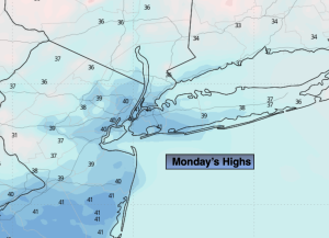
Monday:
Increasing clouds. Highs in the mid 40s.
Tuesday:
Morning snow. Some Afternoon sun. Highs in the mid 30s.
Wednesday:
Partly sunny. Breezy. Highs in the upper 30s.