Synopsis:
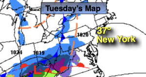
High pressure will be over the region today. The sun will dominate. Temperatures will moderate but still remain several degrees below freezing. We’ll finally break the freezing mark as a southwest wind develops around the departing high pressure on Tuesday. Mostly cloudy skies are expected as a weak frontal boundary moves to our North. Spotty rain or snow showers are possible later in the day.
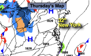
A cold front will push through by Wednesday morning. Readings will once again be above 32º. Sunny skies and seasonably cold temperatures are expected through Thursday and Friday under mainly sunny skies.
Stay tuned.
Keep it here for a no nonsense, no hype forecast…
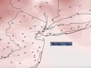
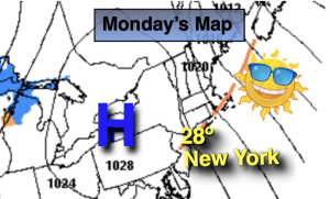
Monday:
Sunny. Not as brutal. Highs in the upper 20s. Northwest winds at 8-12mph.
Tonight:
Mostly cloudy. Not as cold as recent night in urban areas. Lows in the mid 20s along the coast, single digits and teens inland. Northwest winds at 5mph.
Tuesday:
Mostly cloudy. Spot rain or snow shower later in the day. Highs in the mid 30s.
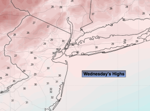
Wednesday:
Partly sunny. Highs in the mid 30s.
Thursday:
Mostly sunny. Highs around freezing.
Friday:
Sunny. Highs around freezing.