Synopsis:
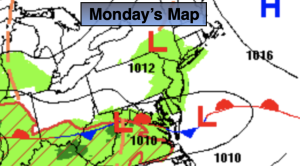
High pressure will dominate today. This should provide decent viewing conditions for the solar eclipse. The only hiccup maybe some high clouds moving in from the West. It’ll be much milder. Highs will be five to seven degrees above the average high of 59º.
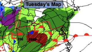
Tuesday will feel like a day out of late May. A warm Southwest flow will dominate around high pressure. Readings will pop into the 70s!
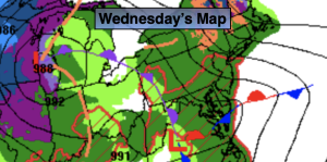
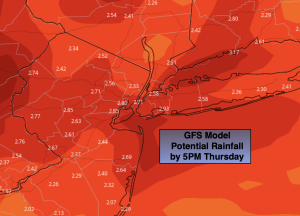
Wednesday through Friday will be unsettled as a warm front approaches Wednesday followed by a cool front passage Friday. On and off showers are likely during this timeframe.
Stay tuned.
Keep it here for a no nonsense, no hype forecast.
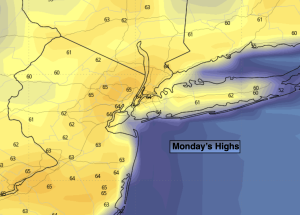
Monday:
Mostly sunny. Some high clouds. Milder. Highs in the lower to mid 60s. Northwest to Southwest winds at 5-10mph.
Tonight:
Mostly cloudy. Lows in the lower 50s in the City, the 40s elsewhere. Light winds.
Tuesday:
Partly sunny. Warmer. Highs in the lower to mid 70s.
Wednesday:
Mostly cloudy. Scattered showers. Highs in the mid to upper 50s.
Thursday:
Mostly cloudy. Scattered showers. Highs in the lower 60s.
Friday:
Mostly cloudy. Scattered showers. Highs in the mid 60s.