Synopsis:
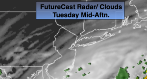
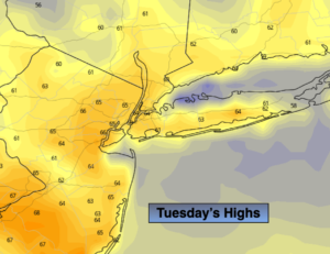
A bright, seasonal Tuesday is expected as high pressure moves overhead. The average high is in the mid 60s.
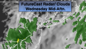
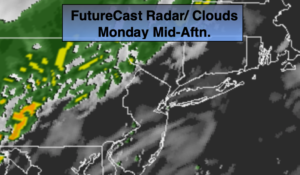
Low pressure will move toward the region on Wednesday. Any early morning sun will give way to thickening clouds. Rain will develop by midday to early afternoon. The low will deepen rapidly at our latitude and move just up and off the coast. A period of heavy rain is possible for the second half of the day. One to three inches of rain is possible by late Wednesday night. Winds may be gusty along the coast.
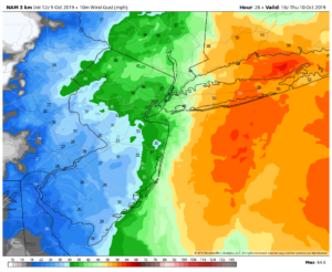
As the storm moves into Eastern New England we’ll dry out but winds will be strong out of the Northwest. Highs may remain in the 50s with winds gusting to 40mph.
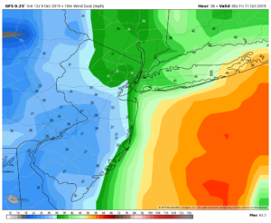
Friday will be chilly with a cool pool of air over the Northeast in the wake of the departing low. Winds will abate some.
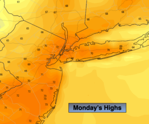
A sneak peek at the weekend-two thumbs up from JMW.
Stay Tuned.
Keep it here for a no nonsense, no hype forecast.
Today:
Sunny. Highs in the lower to mid 60s. Northwest to Southeast winds at 5mph.
Tonight:
Clear and cool. Lows in the lower to mid 50s in the City, the 40s inland. Southeast winds at 5mph.
Wednesday:
Early morning sun giving way to thickening clouds. Rain will develop by midday to early afternoon. The rain could be heavy at times later in the day. Highs in the mid 60s.
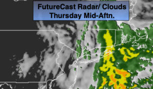
Thursday:
Sun and clouds. Windy and cooler. Highs in the upper 50s.
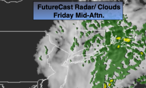
Friday:
Sun and clouds. Breezy and chilly. Highs in the upper 50s.
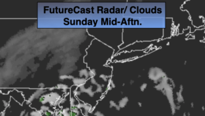
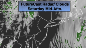
Saturday:
Sunny and seasonal Highs in the lower 60s.