Synopsis:
High pressure will slip offshore today. Any morning sun will give way to increasing and thickening clouds as low pressure and its associated fronts move to the East. It’ll be cooler today than recent days with readings most likely not cracking 50º. The average high is 52º.
Rain will develop tonight and become steady. Thursday will feature the morning steady rain becoming more intermittent during the day. Temperatures will remain just below average.
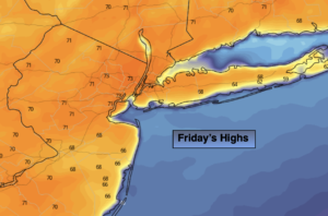
On Friday the system will have swung offshore. Partly sunny, breezy conditions are expected in its wake. It’ll be pleasant with highs several degrees above average.
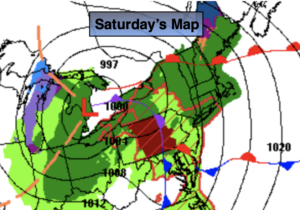
Saturday will weather system will be an upper level low that will move through the Northeast. This will result in an unstable atmosphere. Morning sun will give way to cloudy skies and scattered afternoon showers. Readings will be near seasonable highs.
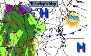
A blast of Canadian air will usher in behind another cold front on Saturday night. This will set the stage for a blustery Sunday under a mix of sun and clouds. Highs will only be in the 40s.
Stay tuned.
Keep it here for a no hype, no nonsense forecast.
Catch me on Fox Weather Stream today from 2pm-5pm. Find us on Tubi, and YouTube TV and as always the Fox Weather App.
Wednesday:
Early sun giving way to increasing and thickening clouds. Cooler. Highs in the upper 40s. Northeast to East winds at 8-12mph.
Tonight:
Rain. Lows around 40º in the City, the 30s elsewhere. East winds at 10-20mph.
Thursday:
On and off rain. Highs around 50º.
Friday:
Partly sunny. Milder. Highs around 60º.
Saturday:
Morning sun, afternoon clouds. Scattered showers. Highs in the mid 50s.
Sunday:
Partly sunny. Windy and cooler. Highs in the mid 40s.