Synopsis:
May’s debut will be a winner. Sunshine will give way to high clouds. Readings will be near the average high of 68º. It’s about time!
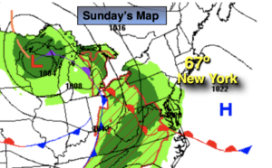
The next chance of showers comes Sunday evening into Monday morning as a weakening front moves through. Monday will chilly with grey skies and a wind off the cold Atlantic.
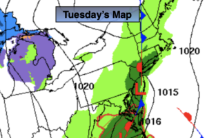
Tuesday will feature partly sunny skies with high pressure moving overhead. Another system will move into the region on Wednesday with another shot of showers. Skies once again will become partly sunny for Thursday as another high pressure ridge moves overhead. Needless to say, every other day there’ll be a chance of showers sandwiched in with days of sunshine. Spring in the Northeast.
Stay tuned.
Keep it here for a no hype, no nonsense forecast.
Tonight:
Clear. Lows in the upper 40s in the City, the 30s and 40s inland. Light and variable winds.
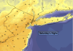
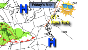
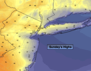
Sunday:
Sun to high clouds. Seasonable. Highs in the mid to upper 60s. Northeast to South winds at 5-10mph.
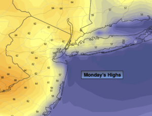
Monday:
Cloudy with morning showers. Much cooler. Highs in the mid 50s.
Tuesday:
Partly sunny. Highs in the lower 60s.
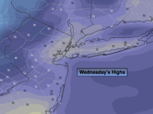
Wednesday:
Mostly cloudy with scattered showers. Highs in the lower 60s.
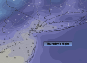
Thursday:
Partly sunny. Highs in the mid 60s.
Catch me on the Fox Business Network this weekend from 6am-9am and the Fox Weather Stream until Noon. Find us on Tubi, Roku TV and YouTube TV and as always the Fox Weather App. It’s Free!