Synopsis:
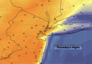
Today will feature a mix of sun and clouds as high off the Southeast coast pumps up warm airmass. Highs will be more reminiscent of May than March. Temperatures will top 70º in many areas away from the coast.
A cold front will move through tonight and Friday morning with a period of rain. Skies will become partly sunny Friday afternoon.
Canadian air will move in for Saturday. It’ll be chilly along with abundant sunshine. Sunday will be bright and seasonal with high pressure overhead.
A warm front will approach on Monday. This will result in mostly cloudy skies with a chance of showers. It’ll be mild.
Stay tuned.
Keep it here for a no nonsense, no hype forecast…
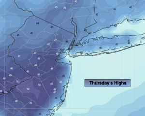
Thursday:
Sun and clouds. Warm. Highs around 70º. Warmer inland, cooler along the coast. Southwest winds at 10-20mph with gusts to 30mph.
Tonight:
Rain. Mild. Lows around 50º in the City, the 40s inland. South winds at 5-10mph.
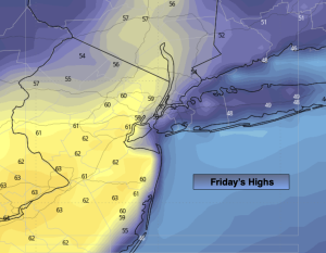
Friday:
AM showers to partly sunny skies. Highs in the mid 50s.
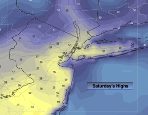
Saturday:
Mostly sunny. Chilly. Highs in the mid 40s.
Sunday:
Sunny. Seasonal. Highs in the lower 50s.
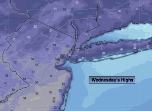
Monday:
Mostly cloudy. Mild. Chance of showers. Highs in the mid to upper 50s.