Synopsis:
There will be more clouds today as a cool front approach. The threat of isolated showers are in the forecast, mainly over Central and Southern NJ. It will not be a washout and the majority of the time will be dry with clouds and sun. It’ll still be warm.
Mother’s Day will be a winner. Plenty of sunshine and near seasonable readings are expected as high pressure moves in from the Northwest.
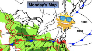
The beginning of the week looks bright and pleasant as high pressure dominates. Readings will be near the seasonable average of the lower 70s.
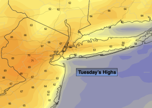
Temperatures will pop on Tuesday ahead of a significant cool front under a mostly sunny sky.
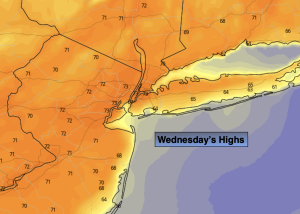
Cooler readings are expected for Wednesday as a Northerly wind prevails.
Stay tuned.
Keep it here for a no nonsense, no hype forecast.
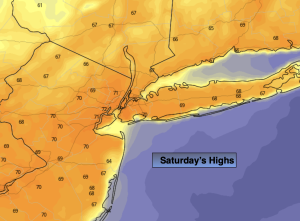
Saturday:
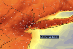
Clouds to some sun. Spotty showers possible mainly South of the City. Highs in the lower 80s. Northwest winds at 8-12mph.
Tonight:
Becoming mostly clear. Lows in the mid 50s along the urban corridor, the 40s inland. North wind at 5-10mph.
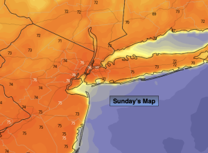
Mother’s Day:
Sunny, breezy and seasonable. Highs in the lower 70s.
Monday:
Sunny. Highs in the lower 70s.
Tuesday:
Sunny. Warmer. Highs around 80º.
Wednesday:
Sunny. Cooler. Highs around 70º.