Synopsis
Merry Christmas!
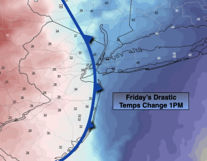
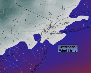
Christmas Eve will be be frigid especially compared to what we experienced 24 hours ago. Readings will only be in the mid to upper teens for highs and the wind will add a bite! Wind chills will be within a few degrees of zero the majority of the day. Please dress in layers and avoid being outdoors for a long period of time. Skies will at least be bright.
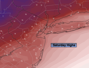
Christmas Day will be frigid. Despite the sunshine readings will remain in the 20s. This will be one of the coldest Christmas’ in years!
We’ll flirt with freezing Monday under a bright sky and come out of the ice box on Tuesday as high pressure moves overhead. The mid to late week period looks quite mild and storm-free.
Stay tuned.
Keep it here for a no hype, no nonsense forecast.
Christmas Eve:
Sunny, windy and frigid. Highs only in the mid to upper teens. Wind chills near 0º the majority of the afternoon. West winds at 15-30mph with higher gusts.
Tonight:
Clear, breezy and frigid. Lows in the mid teens along the urban corridor to the single digits to lower teens inland. Wind chills will be near below zero. West winds 15-325mph with higher gusts.
Christmas Day:
Sunny, breezy and very cold. Highs in the mid to upper 20s. Wind chills in the teens.
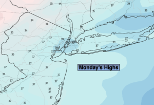
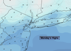
Monday:
Sunny. Cold. Highs around freezing.
Tuesday:
Sunny. Highs in the mid 30s.
Wednesday:
Sunny. Highs in the upper 30s.