Synopsis:
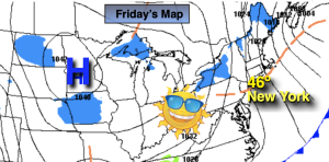
February will return today with guess what? Scattered snow showers and highs near freezing. A weak disturbance will move into the region from the West will be responsible for some areas seeing the flakes. Sunday will be Midler half of the weekend under a mostly sunny sky temperatures will rise to several degrees above the average high of the lower 40s.
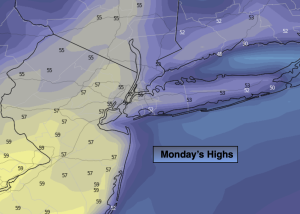
Sun will give way to clouds Monday with readings just above the average high of 43º.
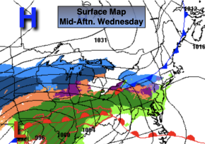
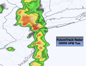
A storm will develop over the Ohio Valley and redevelop along the Mid-Atlantic coast Monday night and move offshore Tuesday. Enough cold air looks to be in place that potential for an accumulating snow will fall over the Northwestern 1/3 of the region. Again, this is a potential. For NYC immediate area, Long Island and South into Central and Southern NJ the majority of the precipitation should fall as rain. A light mix or light rain will continue into the first half of Tuesday. Clouds will hang tough,
The sun will return for a brief break on Wednesday as high pressure says a quick hello.
Stay tuned.
Keep it here for a no hype, no nonsense forecast.
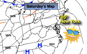
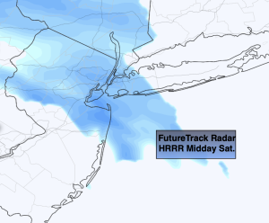
Saturday:
Scattered snow showers, otherwise mainly cloudy. Cold. High in the lower to mid 30s, upper 20s inland. Northeast to South winds at 5mph.
Tonight:
Becoming partly cloudy. Lows around 30º along the urban corridor. The upper teens and 20s inland. West winds under 5mph.
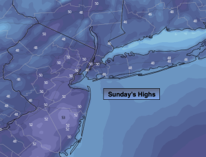
Sunday:
Mostly sunny. Milder. High in the mid to upper 40s.
Monday:
Sun to clouds. High in the mid 40s.
Tuesday:
Light snow, mix, rain in the morning depending on location. Remaining mostly cloudy during the afternoon. Highs in the upper 30s to mid 40s.
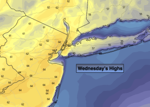
Wednesday:
Mostly sunny. Highs mid 40s.