Synopsis:
There’ll be a nip in the air through Tuesday as Canadian high pressure influences the area. The high will move over the region and off the coast mid to late week. This will result in moderating temperatures. Readings will be near seasonable levels on Wednesday (mid 50s) to above average Thursday and Friday. Abundant sunshine is anticipated through the period. It’s a simple 5 day forecast!
Stay tuned.
Keep it here for a no nonsense, no hype forecast.
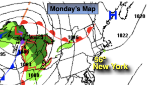
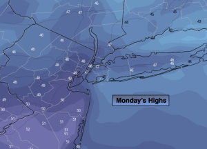
Monday:
Mostly sunny. Chilly. Highs in the upper 40s. Southwest winds at 5mph.
Tonight:
Mostly clear. Lows around 40º along the urban corridor, the 30s inland. Southwest to Northwest winds at 5-10mph.
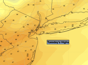
Tuesday:
Mostly sunny. Breezy. Highs in the lower 50s.
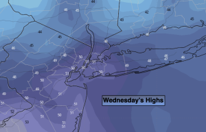
Wednesday:
Sunny. Highs in the lower to mid 50s.
Thursday:
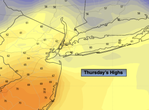
Sunny. Milder. Highs in the upper 50s.
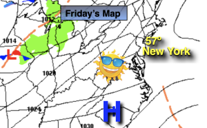
Friday:
Sunny. Mild. Highs in the lower 60s.