Synopsis:
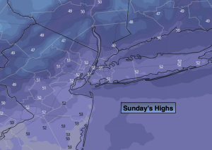
The sun will rule the sky on Sunday but a gusty wind will make it feel colder as a Northwest wind around high pressure takes hold. Readings will be a couple degrees below the average high of 54º.
A chill will greet us for the start of next week under a bright sky as strong high pressure moves in.
The next system will begin to affect our region later Tuesday. Any sun will give way to clouds and possible late day rain as low pressure works its way Northeast from the central Appalachians. Rain is likely Tuesday night into Wednesday morning as the low moves over the region. The weather system will be on the move with the rain ending during the morning and the sun returning. The busiest travel day of the year and least won’t be all wet in our area.
Thanksgiving will be cool and bright as a Northwesterly flow dominates around high pressure over the southeast.
Stay tuned.
Keep it here for a no nonsense, no hype forecast.
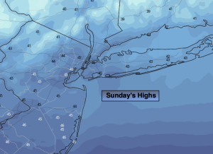
Sunday:
Mostly sunny, breezy and cool. Highs in the lower 50s. West to Northwest winds at 10-15mph with gusts to 25mph.
Tonight:
Clear, breezy and cold. Lows in the mid 30s along the urban corridor, the 20s inland. Northwest winds at 8-12mph with gusts to 20mph early.
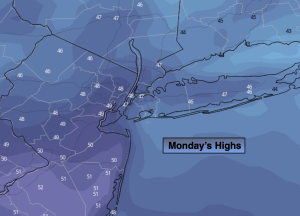
Monday:
Sunny. Chilly. Highs in the mid 40s.
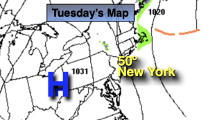
Tuesday:
Sun to clouds. Late day rain possible. Highs around 50º.
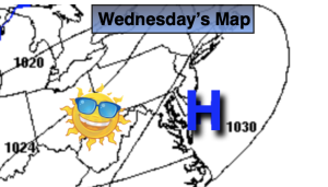
Wednesday:
Morning rain to sun. Highs in the mid 50s.
Thanksgiving:
Mostly sunny. Cool. Highs in the upper 40s.