Synopsis:
Unsettled is the weather word for much of the next 5 days. Three low pressure systems will affect our region through Saturday. Rain is expected today as low pressure moves North into our region. There will be a brief break on Wednesday morning but rain will roll in later in the day as the second low moves up the coast and affect our region into at least Thursday morning. Friday will be the best day of the next five. Abundant sunshine is anticipated as strong high pressure noses in from Eastern Canada. Low pressure number three will move into the East on Saturday with more rain. The area may very well receive a couple inches of rain through this period. Duck weather for sure. It will still be mild as all of the cold air is bottled up in Canada.
Stay tuned.
Keep it here for a no nonsense, no hype forecast..
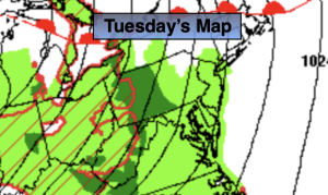
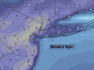
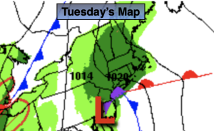
Tuesday:
Rain. Highs around 50º. Northeast winds at 8-15mph.
Tonight:
Early evening rain, otherwise becoming mostly cloudy. Lows in the 40s throughout. Southwest winds at 5mph.
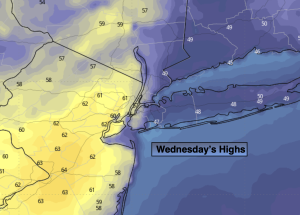
Wednesday:
Mostly cloudy. Rain by afternoon. Highs in the mid 50s.
Thursday:
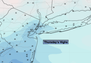
Rain through at least the morning. Remaining mostly cloudy. Highs in the upper 40s.
Friday:
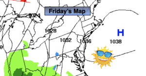
Mostly sunny. Highs in the lower 50s.
Saturday:
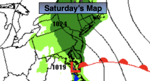
Rain likely. Highs in the upper 40s.