Sun & Clouds Wednesday. Seasonable…


Synopsis:

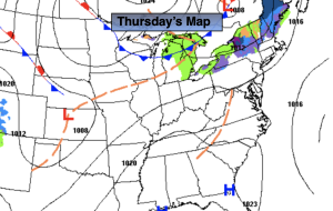
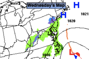
Today and Thursday will be winners as high pressure begins to build into the region. A mix of sun and clouds is expected today and abundant sunshine is expected Thursday. Readings will be at or above the seasonable levels of the mid 60s.

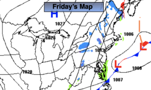
A large trough in the upper atmosphere will result in a couple of unsettled days Friday and Saturday. Low pressure will develop off the coast Friday resulting in on and off rain. On Saturday, a second low will develop somewhere in the Northern Mid-Atlantic or Northeast. Most of the latest computer guidance have the storm North of the region on Saturday. If this outcome is correct, scattered showers will occur with the possibility of even seeing some sun. If the storm develops to our South, a steadier and heavier rain will occur. At this time JMW is leaning toward the first solution. This will be our 7th consecutive Saturday with rain. Oy vey!

The storm will become a powerhouse in New England on Sunday. Windy but dry conditions are expected. There will definitely be a nip in the air.

Stay tuned.

Keep it here for a no nonsense, no hype forecast.

Wednesday:

Becoming mostly sunny. Highs in the mid 60s. Northeast to South winds at 5mph.

Tonight:

Mostly clear. Lows in the lower to mid 50s in urban areas, around 40º inland. Light South to Southwest wind.

Thursday:

Sunny. Milder. Highs in the upper 60s.

Friday:

Cloudy with periods of rain. Highs in the lower 60s.

Saturday:

Mostly cloudy with on and off showers. Highs in the lower 60s.

Sunday:

Mostly cloudy, windy and chilly. Highs in the upper 50s.

Familiar Forecast for Tuesday. Clouds & Sun. Cool…


Synopsis:

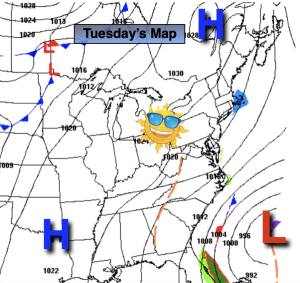
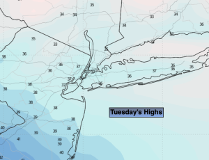
A low pressure trough over the region would result in a familiar forecast for today. A mix of clouds and sun is expected. The chill will remain with readings about five degrees below the average high of the mid 60s.

Wednesday and Thursday will be winners as high pressure begins to build into the region. Abundant sunshine is expected with milder readings.

A Southerly flow will develop on Friday ahead of the next developing low pressure system to our South. Any sun will give way to clouds. Scattered showers are possible during the afternoon.

The computer models have shifted gears from what was once a steadier and heavier rain on Saturday to a more scattered showers outcome. This is due to low pressure not getting its act together until its North of the region. Many days to watch this unfold as we possibly encounter our 7th consecutive Saturday with rain. Oy vey!

Stay tuned.

Keep it here for a no nonsense, no hype forecast.

Tuesday:

Clouds and sun. Highs in the lower 60s. North winds at 5mph.

Tonight:

Mostly clear. Lows in the lower 50s in urban areas, the 40s inland. Light North wind.

Wednesday:

Sunny. Highs in the mid 60s.

Thursday:

Sunny. Milder. Highs in the upper 60s.

Friday:

Increasing clouds. Afternoon showers possible. Highs in the mid to upper 60s.

Saturday:

Threat of on and off showers. Highs in the lower 60s.

Clouds & Sun Monday. Spotty Shower…


Synopsis:

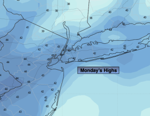
Today will feature a low pressure trough over the region. A mix of clouds and sun is expected. Isolated showers are possible, the best chance is during the afternoon. It’ll be breezy and cool with readings about five degrees below the average high of the mid 60s.

More sun is expected for Tuesday as low pressure pushes out. The chill will remain.

Wednesday and Thursday will be winners as high pressure begins to build into the region. Abundant sunshine is expected with milder readings.

A Southerly flow will develop on Friday ahead of the next developing low pressure system to our South. Any sun will give way to clouds. Scattered showers are possible during the afternoon.

Stay tuned.

Keep it here for a no nonsense, no hype forecast.

Monday:

More clouds than sun. Breezy and cool. Isolated afternoon showers possible, mainly during the afternoon. Highs around 60º.

Tonight:

Becoming mostly clear. Lows in the 40s to around 50º in urban areas. North wind diminishing to 5mph.

Tuesday:

Partly sunny. Highs in the lower 60s.

Wednesday:

Sunny. Highs in the mid 60s.

Thursday:

Sunny. Milder. Highs in the mid to upper 60s.

Friday:

Increasing clouds. Afternoon showers possible. Highs in the mid to upper 60s.

More Clouds Than Sun Sunday. Breezy & Cool…


Synopsis:

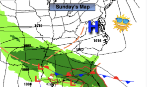
Low pressure that gave the region rain for the first half of the weekend is quickly moving offshore today. More clouds than sun is expected. Temperatures will still be below average (the average high is in the mid60s), but at least we’ll see some sun!  There’ll be a nip in the air with a gusty wind.

Monday will feature an upper level trough over the region. A mix of clouds and sun is expected. Isolated showers are possible during the afternoon.

More sun is expected for Tuesday as low pressure pushes out. The chill will remain.

Wednesday and Thursday will be winners as high pressure begins to build into the region. Abundant sunshine is expected with milder readings!

Stay tuned.

Keep it here for a no nonsense, no hype forecast.

Sunday:

More clouds and sun. Breezy and cool. Highs in the upper 5os. Northwest winds at 15-25mph.

Tonight:

Becoming mostly clear. Lows in the 40s throughout. Northwest winds diminishing to 5-10mph.

Monday:

More clouds than sun. Isolated afternoon showers possible. Highs around 60º.

Tuesday

Partly sunny. Highs in the lower 60s.

Wednesday

Sunny. Highs in the mid 60s.

Thursday

Sunny. Milder. Highs in the mid to upper 60s.

Raw Saturday. Rain Developing This AM…


Synopsis:

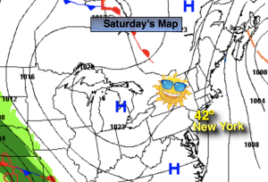
A dramatic change in weather will occur on Saturday as low pressure moves from the Ohio Valley to the Mid-Atlantic coast. Rain will develop this morning. It will be scattered at first then become steadier toward midday. It’ll be a raw day with readings ten degrees lower than the average high of the mid 60s. Rain is likely tonight. The low will exit quickly Sunday morning. Any early showers will give way to a mix of sun and clouds.  Temperatures will still be below average, but at least we’ll see some sun!

Monday and Tuesday will feature an upper level low over the region. More clouds than sun is expected both days. Low pressure at the surface will develop offshore and move out to sea Tuesday. There is a threat of showers Tuesday. Signifiant rain at this time is not expected for the region.

Wednesday will feature more sun as high pressure begins to build into the region.

Stay tuned.

Keep it here for a no nonsense, no hype forecast.

Saturday:

Rain developing. Highs in the mid 50s. North to Northeast winds at 5-10mph.

Tonight:

Rain. Breezy. Lows in the 40s throughout. North to Northeast winds increasing to 10-20mph with higher gusts.

Sunday:

A morning shower, otherwise skies will become partly sunny. Highs in the upper 5os.

Monday:

More clouds than sun.. Highs around 60º.

Tuesday

More clouds than sun. Scattered showers possible. Highs in the upper 50s.

Wednesday

Mostly sunny. Highs in the lower 60s.

Fine Friday…


Synopsis:

Low pressure will move off into the Canadian Maritimes on Friday allowing for high pressure to build in from the North. This will result in a slightly cooler temperatures than recent days. Despite the slight dip in readings it’ll still be a delightful Friday with abundant sunshine.

A dramatic change in weather will occur on Saturday as low pressure moves our way from the Ohio Valley. Rain will develop. The question is the timing. Does it start in the early morning or hold off until afternoon. The latest computer models want to slow the start time of the rain. The morning may turn out dry (maybe a few showers) with rain moving in during the afternoon. Anyway you slice, it’ll have a damp feel. Rain is likely Saturday night into Sunday morning. The low now looks to exit quickly enough on Sunday for a dry afternoon. The sun will make a return. Below average temperatures are expected this weekend. The average high is in the mid 60s.

Monday and Tuesday will feature an upper level low over the region. More clouds than sun is expected with the chance of spotty showers. Low pressure at the surface will develop offshore and move out to sea. Signifiant rain at this time is not expected for the region.

Stay tuned.

Keep it here for a no nonsense, no hype forecast.

Friday:

Sunny. Highs in the lower to mid 60s. North to Northwest winds at 8-12mph.

Tonight:

Mostly clear early, otherwise increasing clouds. Lows around 50º in the City, the upper 30s and 40s inland. North winds at 5mph.

Saturday:

Rain developing. Highs in the upper 50s.

Sunday:

Morning rain. Skies should become partly sunny during the afternoon. Highs in the upper 50s to lower 60s.

Monday:

More clouds than sun. Spot shower. Highs around 60º.

Tuesday

More clouds than sun. Spot shower. Highs in the upper 50s.

Another Winner Thursday…


Synopsis:

Weak weather systems over the Northeast will result in another beauty today. Bright skies and mild temperatures are in the forecast. Typical readings for this time of the year are in the mid to upper 60s, we’ll end up on the high range of that temperature spread. An October delight for sure.

Low pressure will move off into the Canadian Maritimes on Friday allowing for high pressure to build in from the North. This will result in a slightly cooler day. Skies will be mainly sunny with readings at or below normal highs. Still a delightful day.

A dramatic change in weather will occur on Saturday as low pressure moves our way from the Ohio Valley. Rain will develop. The question is the timing. Does it start in the early morning or hold off until afternoon. The latest computer models want to slow the start time of the rain. The morning may turn out dry with rain moving in during the afternoon. Anyway you slice, it’ll have a damp feel. Rain is likely Saturday night into Sunday morning. The low now looks to exit quickly enough on Sunday for a dry afternoon. The sun will make a return. Well below average temperatures are expected this weekend.

Stay tuned.

Keep it here for a no nonsense, no hype forecast.

Thursday:

Mostly sunny. Mild. Highs in the upper 60s. West to Northwest winds at 5mph.

Tonight:

Mostly clear. Lows in the mid 50s in the City, the 40s inland. North winds at 5-10mph.

Friday:

Mostly sunny. Highs in the lower to mid 60s.

Saturday:

Rain developing. Highs in the upper 50s.

Sunday:

Morning rain. Skies should become partly sunny during the afternoon. Highs in the upper 50s.

Monday:

More clouds than sun. Spot shower. Highs in the upper 50s.

Midweek Delight…


Synopsis:

Low pressure in Canada will keep weather systems fairly stationary through Thursday. This will result in mainly sunny skies through the period with near seasonable temperatures. Typical readings for this time of the year are in the mid to upper 60s.

The low will move off the into the Canadian Maritimes on Friday allowing for high pressure to build in from the North. Skies will be mainly sunny with readings at or below normal highs.

A dramatic change in weather will occur on Saturday as low pressure moves our way from the Ohio Valley. Rain will develop. The question is the timing. Does it start in the early morning or hold off until afternoon. Anyway you slice, it’ll be damp. Rain is likely Saturday night into a part of Sunday. Depending on when the low exits the region will determine when the rain will taper off Sunday afternoon. Well below average temperatures are expected this weekend. A raw one for sure.

Stay tuned.

Keep it here for a no nonsense, no hype forecast.

Wednesday:

Sunny. Mild. Highs in the upper 60s. West winds at 5-10mph.

Tonight:

Mostly clear. Lows in the mid 50s in the City, the upper 30s and 40s inland. Light West to North winds.

Thursday:

Mostly sunny. Highs in the upper 60s

Friday:

Mostly sunny. Highs in the lower to mid 60s.

Saturday:

Rain developing. Highs in the upper 50s to around 60º.

Sunday:

Rain. Very cool. Highs in the mid to upper 50s.

Sun & Clouds, Not as Cool Tuesday…


Synopsis:

Low pressure in Canada will keep weather systems fairly stationary through Thursday. This will result in mainly sunny skies through the period with near seasonable temperatures. Typical readings for this time of the year are in the mid to upper 60s.

The low will move off the into the Canadian Maritimes on Friday allowing for high pressure to build in from the North. Skies will be mainly sunny with readings at or below normal highs.

A dramatic change in weather will occur on Saturday as low pressure moves our way from the Ohio Valley. Rain will develop. The question is the timing. Does it start in the early morning or hold off until early afternoon. Anyway you slice, it’ll be damp.

Stay tuned.

Keep it here for a no nonsense, no hype forecast.

Tuesday:

Partly sunny. Highs in the lower to mid 60s. West to Southwest winds at 5-10mph.

Tonight:

Partly cloudy. Lows in the lower 50s in the City, the upper 30s and 40s inland. Light Southwest to West winds.

Wednesday:

Mostly sunny. Highs in the mid 60s.

Thursday:

Partly sunny. Highs in the mid 60s.

Friday:

Mostly sunny. Highs in the lower to mid 60s.

Saturday:

Rain likely. Highs in the upper 50s to around 60º.

Cool Columbus Day. Sun & Clouds…


Synopsis:

The coolest airmass of the young Fall season so far will be with us through Columbus Day. Low pressure in Canada  is responsible for the nip in the air. Skies will be bright for the holiday.

A mix of sun and clouds is expected Tuesday with below average temperatures continuing as the cool flow around Canadian low pressure continues.

Temperatures will be more seasonable mid to late week as the airmass moderates under mainly sunny skies. Typical readings for this time of the year are in the mid to upper 60s.

Stay tuned.

Keep it here for a no nonsense, no hype forecast.

Columbus Day:

Partly sunny. Highs in the lower 60s. West to Southwest winds at 8-12mph.

Tonight:

Partly cloudy. Slight chance of a shower. Lows in the lower 50s in the City, the upper 30s and 40s inland. West to Southwest winds under 5mph.

Tuesday:

Partly sunny. Highs in the mid 60s.

Wednesday:

Mostly sunny. Highs in the mid 60s.

Thursday:

Partly sunny. Highs in the mid to upper 60s.

Friday:

Mostly sunny. Highs in the mid 60s.