Synopsis
Groundhog Day will feature the same ol’ story-clouds. Punxsutawney Phil did not see his shadow-calling for an early Spring. A front will move off the coast in the morning. A shower is possible, otherwise more clouds than sun is expected. Readings will still above the average highs of the upper 30s.
Tolerable conditions are expected for the weekend as high pressure noses in from Eastern Canada. Abundant sunshine and above average temperatures are anticipated. Finally, a day full of sunshine! Monday and Tuesday will be no different with high pressure settling over the East coast.
There are no storms in sight. A dismal outlook for snow lovers.
Stay tuned.
Keep it here for a no nonsense, no hype forecast.\
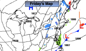
Friday:
Clouds. Spot AM shower. Some sun possible later in the day. Highs in the mid 40s. North winds at 8-12mph.
Tonight:
Becoming mostly clear. Lows around freezing in the City, the upper 20s inland. North winds at 8-12mph.
Saturday:
Sunny. Highs in the lower to mid 40s.
Sunday:
Sunny. Highs in the mid 40s.
Monday:
Sunny. Highs around 40º.
Tuesday:
Sunny. Highs in the upper 30s.