Saturday Special- Warm Sun…


Synopsis:

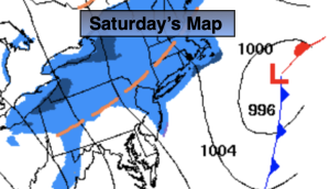
It will be the tale of two seasons this weekend. High pressure over the Southeast will be responsible for our anomalous warmth today. Readings will feel more like June than later October.

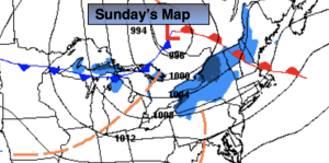
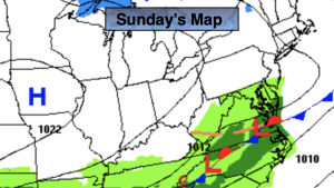
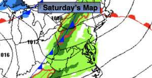
A cool front will move through the region this evening. This will set the stage for much cooler temperatures for Sunday. Highs on Sunday will feel more like mid November with readings almost twenty five degrees cooler than Saturday. Showers are likely on Sunday.

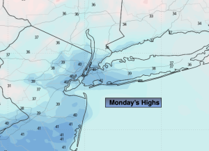
The cool front will get hung up over the region on Monday. A few showers are possible under a mostly cloudy sky.

On Halloween a significant cooldown is expected with dry conditions.

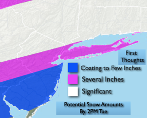
Most of the computer models have a coastal storm developing just off the coast on Wednesday. A period of rain is likely. The threat of some light wet snow is possible over the higher elevations. A few flakes may fly toward the coast as well. It will be chilly with readings staying in the 40s for highs.

Stay tuned.

Keep it here for a no nonsense, no hype forecast.

Saturday:

Mostly sunny. Warm. Highs in the 70s to around 80º. West to Northwest winds at 8-12mph.

Tonight:

Mostly cloudy with scattered showers possible. Lows in the lower 50s along the urban corridor, the 40s inland. Northwest to Northeast winds at 8-12mph.

Sunday:

Cloudy. Scattered showers. Much cooler. Highs in the mid 50s.

Monday:

Mostly cloudy. Scattered showers. Highs in the mid to upper 50s.

Halloween:

Partly sunny. Chilly. Highs in the lower 50s.

Wednesday:

A period of rain possible. Threat of a bit of wet snow inland. Highs in the 40s.

June Feel Friday…


Synopsis:

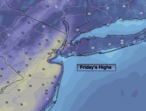
High pressure over the Southeast will dominate our weather through the first half of the weekend. The result will be unusually warm temperatures. It’ll feel more like June than later October through Saturday.

A cool front will move through the region Saturday evening. This will set the stage for much cooler temperatures for Sunday. It’ll be the tale of two season this weekend. Highs on Sunday will feel more like mid November with readings almost twenty five degrees cooler than Saturday. Showers are likely on Saturday.

The cool front will get hung up over the region on Monday. A few showers are possible. Slightly milder air may push up from the South leading to more seasonable readings. The average high is 60º.

On Halloween a signifiant cooldown is expected with dry conditions.

Stay tuned.

Keep it here for a no nonsense, no hype forecast.

Friday:

Clouds and sun. Warm. Highs in the upper 70s. West to Southwest winds at 5-10mph.

Tonight:

Partly cloudy. Lows mid 60s along the urban corridor. This is warmer than the average high for the date. Readings will be in the 50s inland. Light West to Southwest wind.

Saturday:

Mostly sunny. Warm. Highs in the upper 70s.

Sunday:

Cloudy. Scattered showers. Much cooler. Highs in the mid 50s.

Monday:

Mostly cloudy. Seasonable. Scattered showers. Highs around 60º.

Halloween:

Partly sunny. Chilly. Highs in the lower 50s.

Thursday Temps Soar…


Synopsis:

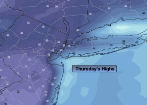
A large dome of high pressure over the Eastern seaboard will dominate our weather through the first half of the weekend. The result will be soaring temperatures. It’ll feel more like early June than later October through Saturday.

A cool front will move through the region Sunday with scattered showers. Cooler temperatures are expected but readings will still be above the average high of around 60º. The front will meander along the Eastern seaboard on Monday. Conditions will be similar to that of Sunday.

Looking down the pike for Halloween a signifiant cooldown is expected with dry conditions.

Stay tuned.

Keep it here for a no nonsense, no hype forecast.

Thursday:

Mostly sunny. Warm. Highs in the mid to upper 70s. Light Southwest wind.

Tonight:

Partly cloudy. Lows in the lower to mid 60s along the urban corridor, the 40s and 50s inland. Light Southwest wind.

Friday:

Mostly sunny. Warm. Highs in the mid to upper 70s.

Saturday:

Mostly sunny. Warm. Highs in the upper 70s.

Sunday:

Mostly cloudy. Scattered showers. Cooler half of the weekend. Highs in the mid 60s.

Monday:

Mostly cloudy. Scattered showers. Highs in the mid 60s.

Midweek Delight…


Synopsis:

A large dome of high pressure over the Eastern seaboard will dominate our weather the entire week and into the weekend. The result will be delightful weather and the start of  a significant warming trend. Highs will feel more like early June than later October by late week! Yep, it’s that simple, enjoy!

Stay tuned.

Keep it here for a no nonsense, no hype forecast.

Wednesday:

Sunny. Warmer. Highs in the lower 70s. Southwest winds at 5-10mph.

Tonight:

Partly cloudy. Lows around 60º along the urban corridor, the 40s inland. Light Southwest wind.

Thursday:

Sunny. Warm. Highs in the mid 70s.

Friday:

Mostly sunny. Warm. Highs in the mid 70s.

Saturday:

Mostly sunny. Warm. Highs in the mid to upper 70s.

Sunday:

Mostly cloudy. Spotty showers possible. Mild. Highs in the lower 70s.

Sct’d AM Frost. Milder Sun Tuesday…


Synopsis:

A large dome of high pressure will dominate our weather the entire week and into the weekend. The result will be delightful weather and the start of  a significant warming trend. Highs will feel more like early June than later October by late week! Yep, it’s that simple, enjoy!

Stay tuned.

Keep it here for a no nonsense, no hype forecast.

Tuesday:

AM scattered frost inland. Sunny. Milder. Highs in the mid 60s. Winds becoming South at 5mph.

Tonight:

Clear. Lows in the mid 50s along the urban corridor, the 30s and 40s inland. Light Southwest wind.

Wednesday:

Sunny. Warmer. Highs in the lower 70s.

Thursday:

Sunny. Warm. Highs in the mid 70s.

Friday:

Mostly sunny. Warm. Highs in the mid 70s.

Saturday:

Mostly sunny. Warm. Highs in the mid to upper 70s.

Frosty Night for Many. Milder Sun Tuesday…


Synopsis:

Clear skies and calm winds tonight will result in the likelihood of scattered frost inland. Readings will flirt with the freezing mark in the distant ‘burbs. Yep, there maybe some frost on the pumpkin.

A large dome of high pressure will dominate our weather the entire week and into the weekend. The result will be delightful weather and the start of  a significant warming trend. Highs will feel more like early June than later October by late week!

Stay tuned.

Keep it here for a no nonsense, no hype forecast.

Tonight:

Clear. Scattered frost inland. Lows in the upper 40s along the urban corridor, the 30s to around freezing inland. Light North wind.

Tuesday:

Sunny. Milder. Highs in the mid 60s. Winds becoming South at 5mph.

Wednesday:

Sunny. Warmer. Highs in the lower 70s.

Thursday:

Sunny. Warm. Highs in the mid 70s.

Friday:

Mostly sunny. Warm. Highs in the mid 70s.

Saturday:

Mostly sunny. Warm. Highs in the mid to upper 70s.

Chilly, Bright Monday…


Synopsis:

High pressure to our West will be responsible for our chilly, bright conditions today. Readings will be a few degrees below the average high of the lower 60s.

Clear skies and calm winds tonight will result in the likelihood of scattered frost inland as readings flirt with the freezing mark.

The high will dominate our weather the entire week bringing with it delightful weather and the start of  a significant warming trend. High will feel more like early June than later October!

Stay tuned.

Keep it here for a no nonsense, no hype forecast.

Monday:

Mostly sunny, breezy in the morning. Cool. Highs in the upper 50s. Northwest winds at 10-20mph and diminishing.

Tonight:

Clear. Lows in the upper 40s along the urban corridor, the 30s to around freezing inland. Light North wind.

Tuesday:

Sunny. Milder. Highs in the mid 60s.

Wednesday:

Sunny. Warmer. Highs in the lower 70s.

Thursday:

Sunny. Warm. Highs in the mid 70s.

Friday:

Mostly sunny. Warm. Highs in the mid 70s.

Areas of AM Rain Slowly Tapers Off. Some Sun West…


Synopsis:

This is our 7th consecutive Saturday with rain. Oy vey! Low pressure will move from just East of NYC this morning to Eastern New England by later today. On its journey it will intensify rapidly. There will be a shield of rain on the Western side of the storm that will affect much of the NYC vicinity this morning. The band of rain will move to the North and East during the afternoon. Rain will taper off along the urban corridor toward midday. Rain will continue for parts of Long Island and Connecticut during the afternoon. Farther to the West clouds should break for some sun. Winds will pick up behind the departing low. Gusts up to 35mph are likely. Secure any Halloween decorations!

The storm will become a powerhouse in Maine and the Canadian Maritimes on Sunday. Windy but dry conditions are expected. There will definitely be a nip in the air under a mix of clouds and sun.

It’ll be a bright and cool start to the week as high pressure moves in from the West on Monday. This high will settle over the region on midweek bringing with it delightful weather and the start of a warming trend.

Stay tuned.

Keep it here for a no nonsense, no hype forecast.

Saturday:

Areas of rain along the urban corridor this morning. Rain will taper off from West to East midday, but continue over parts of Long Island and Connecticut. The sun should make a visit for the Western burbs. Becoming windy during the afternoon. Highs in the lower 60s. Northwest winds at 15-25mph with gusts to 35mph.

Tonight:

Partly cloudy and windy. Lows in the 40s throughout. West to Northwest winds at a 10-20mph with gusts to 30mph.

Sunday:

Clouds and sun, windy and chilly. Highs in the mid to upper 50s.

Monday:

Mostly sunny. Cool. Highs in the upper 50s.

Tuesday:

Sunny. Seasonable. Highs in the lower to mid 60s.

Wednesday:

Sunny. Milder. Highs in the upper 60s.

On & Off Showers to End the Week…


Synopsis:

A large trough in the upper atmosphere will result in a couple of unsettled days.  Low pressure will develop along the Virginia coast today resulting in on and off showers. There will be dry times. The low will move just East of NYC early Saturday morning. On and off rain is likely tonight into Saturday morning. Saturday will not be a washout. Morning showers will give way to some afternoon sun as the low continues its Northeast trek through Eastern New England. This will be our 7th consecutive Saturday with rain. Oy vey! Winds will pick up Saturday behind the departing low.

The storm will become a powerhouse in Maine and the Canadian Maritimes on Sunday. Windy but dry conditions are expected. There will definitely be a nip in the air under a mix of clouds and sun.

It’ll be a bright and cool start to the week as high pressure moves in from the West on Monday. This high will settle over the region on Tuesday bringing with it delightful weather and the start of a warming trend.

Stay tuned.

Keep it here for a no nonsense, no hype forecast.

Friday:

Cloudy with on and off showers. Steadier rain at times from the City and to the East. Highs in the lower to mid 60s. Southeast winds at 8-12mph with gusts to 20mph.

Tonight:

On and off showers. Lows in the 50s throughout. Southeast to West winds at 5-10mph with gusts to 20mph.

Saturday:

Morning showers giving way to some afternoon sun. Becoming windy during the afternoon. Highs in the lower to mid 60s.

Sunday:

Clouds and sun, windy and chilly. Highs in the mid to upper 50s.

Monday:

Mostly sunny. Cool. Highs in the upper 50s.

Tuesday:

Sunny. Seasonable. Highs in the lower to mid 60s.

Bright, Mild Thursday…


Synopsis:

It’ll be a winner today with plenty of sunshine for a change as high pressure influences our conditions along the East coast.  Readings will be around seasonable levels of the mid 60s.

A large trough in the upper atmosphere will result in a couple of unsettled days Friday and Saturday. Low pressure will develop along the Virginia the coast Friday resulting in on and off showers. The low will move just East of NYC early Saturday morning. On and off rain is likely Friday night into Saturday morning. The picture now is much clearer. Saturday will not be a washout. Morning showers will give way to some afternoon sun as the low continues its Northeast trek through Eastern New England. This will be our 7th consecutive Saturday with rain. Oy vey!

The storm will become a powerhouse in Maine on Sunday. Windy but dry conditions are expected. There will definitely be a nip in the air under a mix of clouds and sun.

It’ll be a bright and cool start to the week as high pressure moves in from the West.

Stay tuned.

Keep it here for a no nonsense, no hype forecast.

Thursday:

Mostly sunny. Milder. Highs in the mid 60s.

Tonight:

Increasing clouds. Lows in the 50s throughout. Light South wind.

Friday:

Cloudy with on and off rain. Highs in the lower 60s.

Saturday:

Morning showers giving way to some afternoon sun. Highs in the lower to mid 60s.

Sunday:

Clouds and sun, windy and chilly. Highs in the mid to upper 50s.

Monday:

Mostly sunny. Cool. Highs in the mid to upper 50s.