Synopsis:
March’s debut will feature a cold front moving through in the morning with rain or snow showers depending on location. The snow may coat the ground over the Northern 1/2 of the region. Southern areas may not see much in the way of showers. The sun will return shortly thereafter. Temperatures will be much colder than Saturday’s Spring Preview.
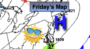
Monday will be dry as cold high pressure moves to the Northeast. Sunny skies are expected. It’ll be cold with most readings remaining at or below freezing.
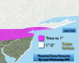
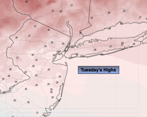
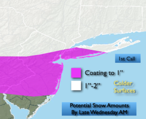
A warm front will approach on Tuesday. It maybe just cold enough at the onset for a light mix Tuesday morning. Warmer air will work in any frozen precipitation will go over to rain during the afternoon.
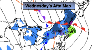
The front will clear the coast Wednesday morning. Mostly cloudy skies are expected with readings slightly above average.
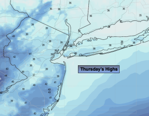
A warm front will approach Thursday with scattered showers and milder temperatures.
Stay tuned.
Keep it here for a no nonsense, no hype forecast…
Sunday:
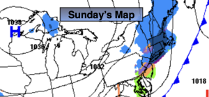
Scattered morning rain or snow showers, otherwise becoming mostly sunny. Highs around 40º. North winds at 10-15mph with gusts to 20mph.
Tonight:
Clear and cold. Lows around 20º in the City, the teens North and West. North winds at 8-12mph with gusts to 20mph.
Monday:
Mostly sunny. Much colder. Highs around freezing.
Tuesday:
Mix/rain depending on location going over to rain. Highs around 40º.
Wednesday:
Mostly cloudy. Highs in the upper 40s.
Thursday:
Mostly cloudy. Scattered showers. Milder. Highs in the lower 50s.