Synopsis:
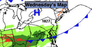
Today will be the last day of our stretch of late Spring-like conditions. The temperature will all depend on your location. There will be a thirty to forty degree difference in readings from inland to the coast. The chill will be attributed to the much colder Atlantic sea breeze. A mix of sun and clouds are expected. A late day or evening shower or thunderstorm can’t be ruled out with energy moving in from the West.
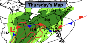
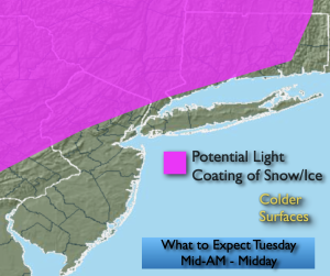
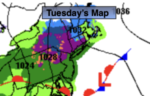
A cold front will move through the region Thursday morning. It’ll be mild to start. Showers will accompany the front and temperatures will drop during the day. A few snow showers are possible during the mid to late afternoon!
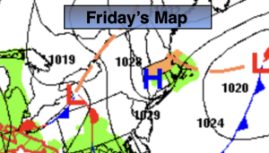
More seasonal conditions are expected for Friday as cooler air settles upon the region. Saturday will be bright and pleasant as high pressure moves overhead. Sunday will feature more of the same with readings a couple of degrees above average.
Stay tuned.
Keep it here for a no nonsense, no hype forecast…
Wednesday:
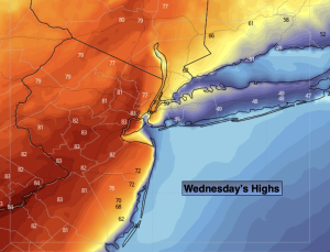
Sun and clouds. Highs in the lower 70s. Warmer inland, cooler at the coast. Late day or evening shower or thunderstorm is possible.
Tonight:
Mostly cloudy. Scattered showers and isolated storms. Mild. Lows in the 50s throughout. Southwest winds 8-12mph.
Thursday:
Scattered morning showers. A few snow showers possible later in the day. Early morning highs around 60º. Temperatures falling during the afternoon.
Friday:
Partly sunny. Seasonal. Highs in the mid to upper 40s.
Saturday:
Sunny and pleasant. Highs around 50º.
Sunday:
Mostly sunny. Highs in the lower 50s.