Synopsis:
High pressure will continue to dominate today but an weak disturbance moving through will cause mainly grey skies. Readings will be below seasonal averages. The average high is 43º.
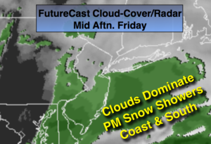
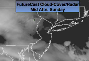
Spotty snow showers or a mix of sleet, light freezing rain or rain is possible overnight. This shouldn’t add up to much but use caution with untreated surfaces.
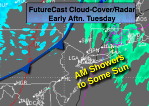
The beginning of the workweek looks mild as a southwest flow develops ahead of the next cold front that will move through the region Tuesday night. Clouds will dominate the sky. Readings by Tuesday will be well into the 50s!
Looking down the pike. Temperatures will be above average into next weekend. After this time frame it does get interesting. The jet stream will be active and there is a decent amount of cold air just to our North during the days in and around Christmas. Areas of low pressure will ride along the deep trough in the jet stream. How will it all play out?
Stay tuned.
Today:
Mostly cloudy and chilly. Highs in the mid to upper 30s. North to Northeast winds at 5mph.
Tonight:
Cloudy with spotty snow showers or a light mix. Lows in the lower to mid 30s in the City, the 20s inland. East winds at 5mph.
Monday:
Mostly cloudy, milder. Highs in the mid 40s.
Tuesday:
Partly sunny, mild. Highs in the lower 50s.
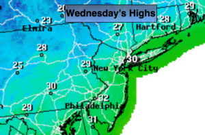
Wednesday:
Partly sunny, breezy and colder. Highs in the lower 40s.
Thursday:
Partly sunny, breezy and chilly. Highs in the upper 30s.
Keep it here for a no nonsense, no hype forecast.