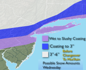
Synopsis:
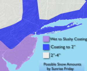
The storm that gave the area a mix of wintry precipitation will move off the coast tonight ending any rain. Skies will clear late.
Dry, tranquil conditions are expected for the end of the week as high pressure moves toward the East coast.
A Southerly flow will develop around the departing high this weekend. This will result in mainly cloudy skies with on and off showers ahead of an approaching cold front late Sunday. It will be mild.
Looking down the pike no major storms are on the horizon.
Stay tuned.
Tonight:
Rain ends this evening, becoming mostly clear. Lows in the upper 20s in the city, the teens & 20s inland. Northwest winds increasing to 15-25mph.
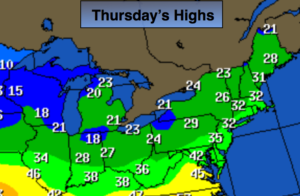
Thursday:
Mostly sunny. Highs in the mid 30s. Northwest winds at 10-15mph.
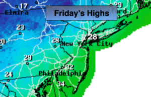
Friday:
Mostly cloudy. Highs in the mid to upper 30s.
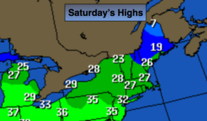
Saturday:
Mostly cloudy. Afternoons showers are possible. Highs in the mid to upper 40s.
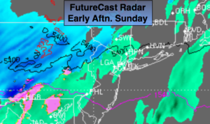
Sunday:
Periods of rain. Highs in the mid to upper 40s.
Monday:
Mostly sunny. Highs in the lower 40s.
Keep it here for a no nonsense, no hype forecast.