Synopsis:
High pressure will dominate the Eastern one third of the nation into the weekend. The result will be plenty of sunshine and cooler than average readings through today as a pool of cool air sits over the area from Eastern Canada. The average high temperature is 75º.
A significant warm up is expected into the weekend-the last weekend of Summer as High pressure moves off the coast and the flow becomes Southwesterly. Autumn arrives on Monday but the conditions will still be Summer-like.
Hurricane Humberto lashed Bermuda last night with winds over 100mph. The hurricane is now moving away from the island and into the far Atlantic.
Stay Tuned.
Keep it here for a no nonsense, no hype forecast.
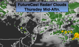
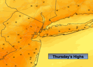
Today:
Sunny. Highs around 70º. Northeast winds at 5mph.
Tonight:
Clear and cool. Lows in the upper 50s in urban areas, the 40s inland. Light West winds.
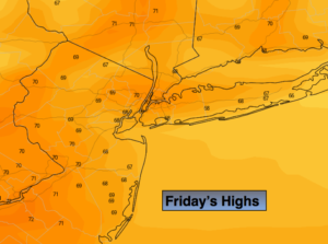
Friday:
Sunny, milder. Highs in the mid to upper 70s.
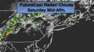
Saturday:
Sunny. Warm. Highs in the lower to mid 80s.
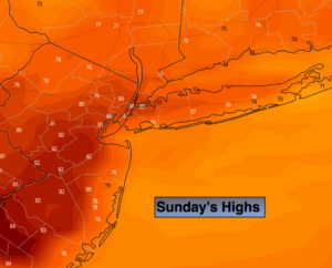
Sunday:
Sunny. Warm. Highs in the mid 80s.
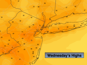
Monday:
Partly sunny. Warm. Highs in the mid 80s.