Synopsis:
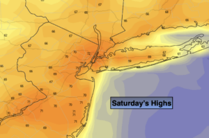
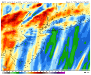
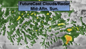
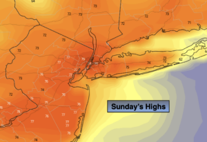
The weak disturbance that moved through early this morning with showers will move offshore. The sun will return during the morning and it will get warm. Some urban areas may push 80º! The average high is 67º.
A cool front will move through the region tonight. Scattered showers are once again likely.
Monday and Tuesday will be partly to mostly sunny with below average temperatures as high pressure noses in from Canada.
By Wednesday into Thursday more clouds will be in the picture as weak disturbances move through. The greatest chance of some showers looks to be Thursday.
Stay Tuned.
Keep it here for a no nonsense, no hype forecast.
Today:
Early morning showers, otherwise becoming mostly sunny and warm. Highs in the mid 70s to around 80º. West winds at 8-12mph.
Tonight:
Becoming mostly cloudy. Scattered showers late. Lows in the mid 50s in the City, the upper 40s to lower 50s inland. West to Northwest winds at 5-10mph.
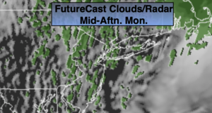
Monday:
Partly sunny. Breezy. Highs in the lower to mid 60s.
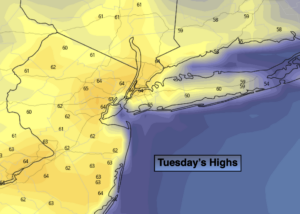
Tuesday:
Partly sunny. Highs in the lower 60s.
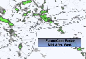
Wednesday:
Mostly cloudy. Highs around 60º.
Thursday:
Mostly cloudy. Chance of showers. Highs around 60º.