
Synopsis:
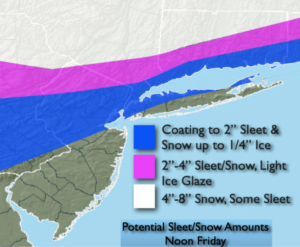
Tonight and Friday will feature a low developing and moving up the spine of the Appalachians and then off the coast just to our South. It should be cold enough for a period of snow, sleet and freezing rain at the onset tonight in most areas (the exception being the immediate coast). The precipitation will begin just after midnight.
The first two bands will be mainly sleet and freezing rain with a bit of snow North. The white band will be mainly snow and some sleet with much higher totals. Sleet and freezing rain is the most dangerous type of precipitation for travel. Please use caution tomorrow morning, especially in untreated areas. Southern areas this is not your Winter storm-rain will fall.
This will all end by midday Friday with some sunshine expected some time during the afternoon. Highs will rebound close to 40º in many areas. Well into the 40s to the South, the 30s to the North.
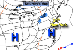
Cold high pressure will work into the region on Saturday. At least the sun will shine.
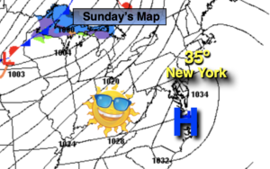
Sunday will feature a mix of sun and clouds with seasonal readings.
An Arctic front will move in Monday with readings remaining in the 20s despite the sunshine.
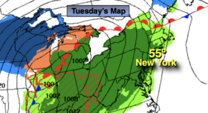
Tuesday will feature not as harsh readings under a mix of sun and clouds.
Stay tuned.
Tonight:
Snow, sleet, freezing rain and rain developing after midnight. The precipitation type will depend on your location. Lows in the 20s and 30s. East to Northeast winds at 5-10mph. .
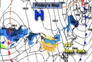
Friday:
Freezing rain or rain by the coast depending on your location. Snow, sleet, freezing rain and rain inland, again depending on your location. Some afternoon sun. High in the mid to upper 30s inland, near 40º in the NYC vicinity, well into the 40s over Southern areas. Northeast to Northwest winds increasing to 15-25mph during the afternoon.
Saturday:
Mostly sunny and cold. High in the mid 30s.
Sunday:
Partly sunny. Seasonal. High in the lower to mid 40s.
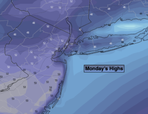
Monday:
Mostly sunny. Quite cold. High near 30º.
Tuesday:
Partly sunny. High in the lower 40s.