Synopsis:
We’ll come out of the ice box, just barely for coastal areas today. A mix of sun and clouds is expected. It’ll be a better feel Wednesday as a Southwest flow of somewhat milder air works in ahead of an approaching cold front. A few showers are possible, snow showers inland.
Thursday will be windy and chilly behind a cold front.
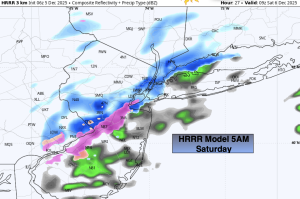
Friday and Saturday will feature more clouds than sun as weak systems move across the region.
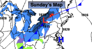
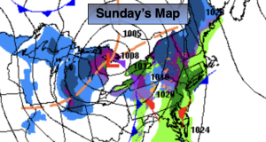
The coldest air of the season so far will on Sunday. Will there be a touch of snow? Some of the computer models are hinting at it.
Stay tuned.
Keep it here for a no nonsense, no hype forecast…
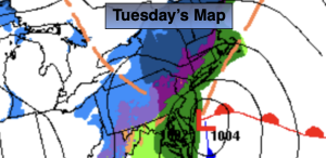
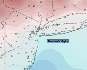
Tuesday:
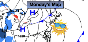
Partly sunny. Highs in the lower to mid 30s. Northeast to South at 5-10mph.
Tonight:
Becoming mostly cloudy. Lows in the mid 30s the City, 20s inland. Southwest winds at 8-12mph.
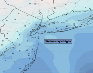
Wednesday:
Mostly cloudy. Milder. Chance of afternoon showers. Snow showers well inland. Highs in the mid 40s.
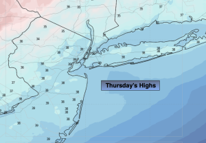
Thursday:
Partly sunny. Highs near 40º.
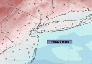
Friday:
Clouds and sun. Highs in the upper 30s.
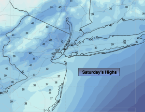
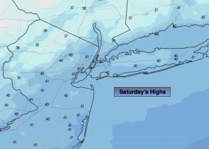
Saturday:
Clouds and sun. Highs in the mid to upper 30s.