Synopsis:
The first weekend of Spring will be a winner. Bright skies and well above average temperatures are expected. Readings by Sunday will reach well into the 60s! A few late day showers are possible Sunday as a cool front moves in. Showers are likely Sunday night. Monday will be more seasonal with readings in the lower 50s under a mix of sun and clouds.
High pressure will move overhead on Tuesday. Sunny skies and cool temperatures are anticipated. Wednesday will feature plenty of sun and typical readings for this time of the year.
Stay tuned.
Keep it here for a no nonsense, no hype forecast…
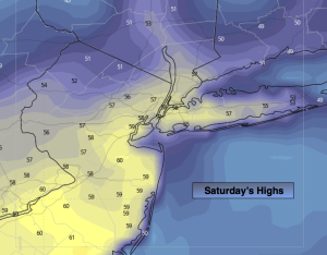
Saturday:
Mostly sunny. Mild. Highs around 60º. Northwest winds at 8-12mph.
Tonight:
Partly cloudy. Lows in mid 40s in the City, the upper 30s inland. Southeast winds at 5mph.
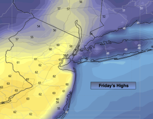
Sunday:
Partly sunny. Milder. Showers by late day. Highs in the mid 60s.
Monday:
Partly sunny, more seasonal. Highs in the lower 50s.
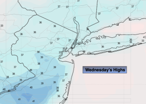
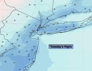
Tuesday:
Sunny and cool. Highs in the mid to upper 40s.
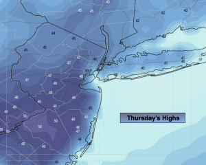
Wednesday:
Bright and seasonal. Highs around 50º.