Synopsis:
The next several days will bring what September is known for- excellent weather. High pressure will move in and dominate from the Northwest. Today through Sunday will be late Summer winners with abundant sunshine and comfortable readings. Readings today and Friday will be below average as cooler air works in from our Canadian friends. Temperatures will then get back above average by the weekend as the winds blow from the Southwest around the area of high pressure.
The next few nights will feature a fall-like chill. Trading the AC for a blanket right here!
Enjoy!
Keep it here for a no hype, no nonsense forecast.
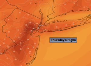
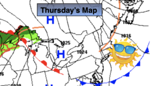
Thursday:
Sunny. Cooler. Highs in the mid 70s. Northwest winds at 8-12mph.
Tonight:
Clear. Cooler. Lows in the mid 50s in the City, the 40s to lower 50s in the ‘burbs. North winds winds at 5mph.
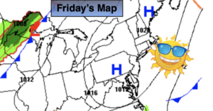
Friday:
Sunny. Highs in the mid 70s.
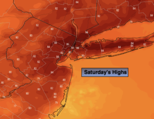
Saturday:
Sunny. Highs in the upper 70s.
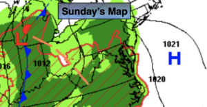
Sunday:
Sunny, warmer. Highs in the lower to mid 80s.
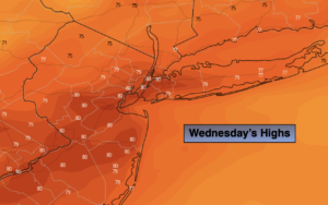
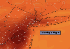
Monday:
Mostly sunny. Highs in the lower 80s.
Catch me Thursday on the Fox Weather Stream from 10am-1pm. Find us on Tubi, Roku TV and YouTube TV and as always the Fox Weather App. It’s Free!