Synopsis:
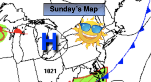
High pressure over the region will move off the Mid-Atlantic coast through Tuesday. Today will be a gem with abundant sunshine, seasonable readings and low humidity.
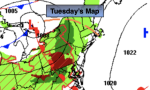
It’ll heat up on Tuesday as a well developed Southwesterly wind around the high takes hold. Readings will be around 90º in many areas and there will be a noticeable increase in humidity. Scattered thunderstorms are possible toward evening with an approaching cool front.
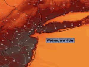
Wednesday through Friday won’t be as hot or humid as the heat bubble moves offshore. Temperatures will be around or just above the average high of 85º. The sun will dominate the sky.
Stay tuned.
Keep it here for a no hype, no nonsense forecast.
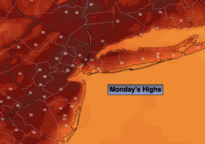
Monday:
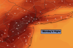
Sunny. Highs in the mid 80s. Southwest to South wind increasing to 10-20mph with higher gusts.
Tonight:
Clear. Milder than recent nights. Lows in the lower 70s in the City, the 60s North and West. Light Southwest wind.
Tuesday:
Hazy, hot and humid. Highs in the lower. Scattered storms possible toward evening. Highs around 90º.
Wednesday:
Mostly sunny. Very warm. Not as humid. Highs in the upper 80s.
Thursday:
Partly Sunny. Highs in the mid to upper 80s.
Friday:
Partly Sunny. Highs in the mid 80s.
Catch me on the Fox Business Network this weekend until 9am Weather Stream until 10am. Find us on Tubi, Roku TV and YouTube TV and as always the Fox Weather App. It’s Free!