Synopsis:
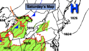
Say Goodbye to the sun for a while. Clouds will rule today as high pressure slips offshore and moisture builds in from the South. Scattered showers are possible just about anytime, but the best chance is in the afternoon. Readings will be cooler than Sunday, most likely staying in the mid 70s. The average high is 78º.
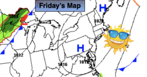
The beginning of the workweek looks unsettled as a Southerly moist flow develops around the departing high and an approaching weak low from the Midwest. Not much rainfall is expected. Spotty showers are in the forecast. The majority of the time will be dry.
Wednesday and Thursday will be late Summer winners with abundant sunshine and comfortable readings as high pressure works in.
Keep it here for a no hype, no nonsense forecast.
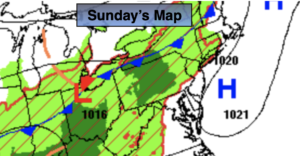
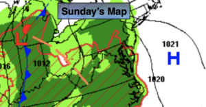
Sunday:
Mostly cloudy. Scattered showers. There will be dry times. Highs in the lower to mid 70s. Light Southwest winds.
Tonight:
Scattered showers. Lows in the upper 60s in the City, the lower 60s in the ‘burbs. East winds less than 5mph.
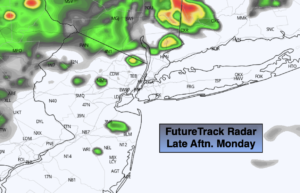
Monday:
Mostly cloudy with spotty showers. Highs around 80º.
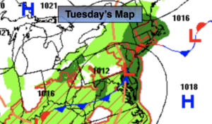
Tuesday:
Mostly cloudy with spotty showers. Highs around 80º.
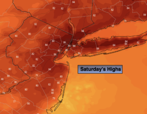
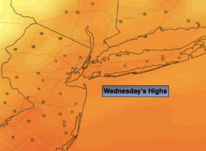
Wednesday:
Sunny. Highs around 80º.
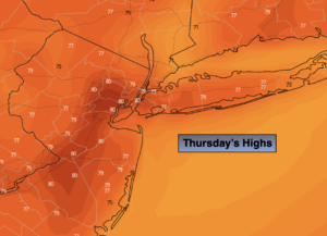
Thursday:
Sunny. Highs in the mid to upper 70s.
Catch me Sunday on the Fox Business Network from 6am-9am and on the Fox Weather Stream until 10am. Find us on Tubi, Roku TV and YouTube TV and as always the Fox Weather App. It’s Free!