Synopsis:
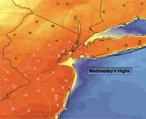
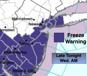
A freeze is likely for most of the area tonight as a Canadian high moves overhead. Wednesday will be chilly but bright. Readings will be around ten degrees below the average high of the upper 50s.
Sunny, cool conditions are expected Thursday.
Moderating temperatures are expected at the end of the week with a Southwest winds around an Atlantic high. Skies will be bright.
The weekend will be a winner with abundant sunshine and mild temperatures as high pressure continues to dominate. We are in for a dry stretch.
Stay tuned.
Keep it here for a no nonsense, no hype forecast…
Tonight:
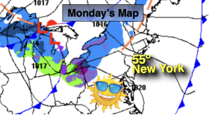
Mostly clear. Breezy and cold. Lows in the lower 30s in the City, the 20s inland. North winds at 8-15mph with gusts to 25mph and diminishing.
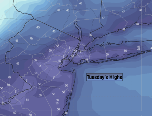
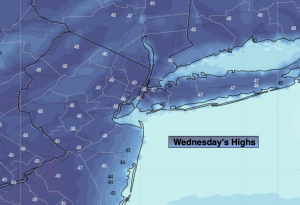
Wednesday:
Sunny. Chilly. Highs around 50º. Northeast to Southeast winds at 5-10mph.
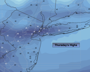
Thursday:
Sunny. Highs in the mid to upper 50s.
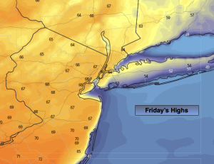
Friday:
Mostly sunny. Milder. Highs in the mid to upper 60s.
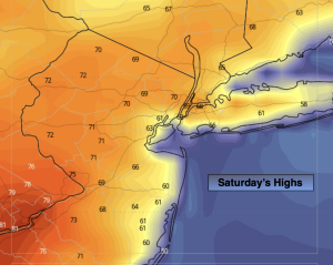
Saturday:
Mostly sunny. Highs in the mid 60s.
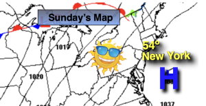
Sunday:
Mostly sunny. Highs in the mid 60s.