Synopsis:
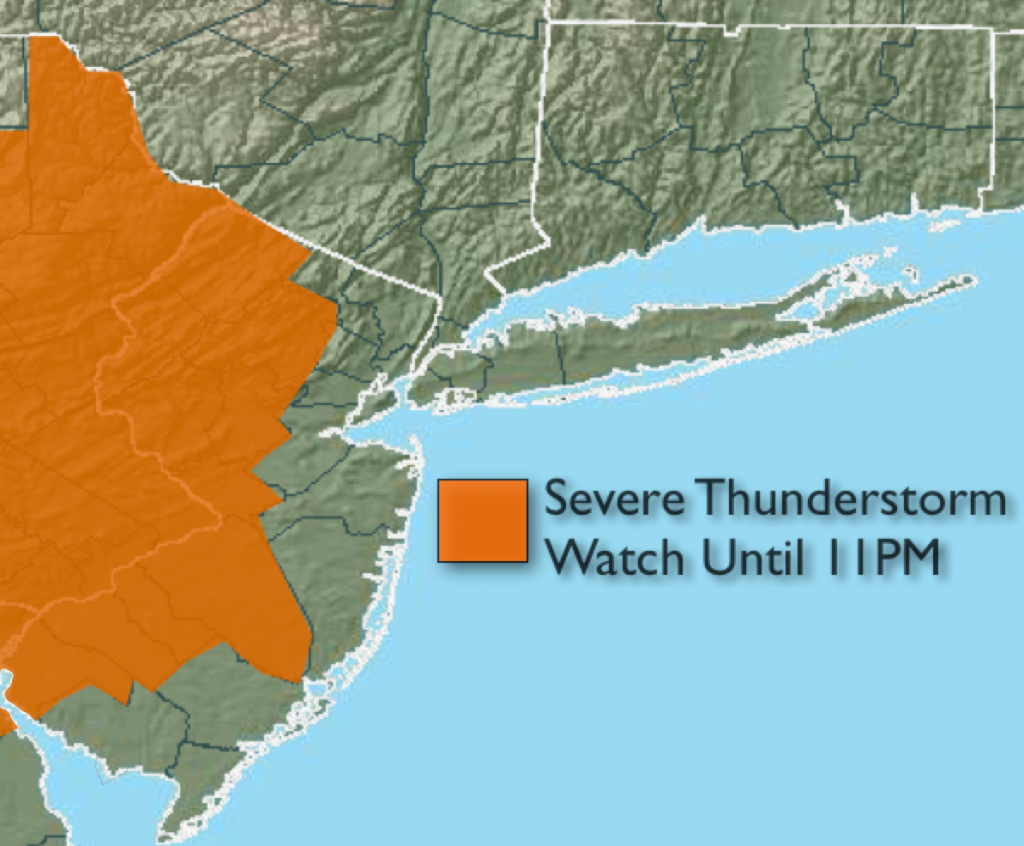
A severe thunderstorm watch is in effect until 11pm for parts of NJ. Some of the storms may become severe this evening. Keep any eye to the sky for threatening weather conditions. Severe thunderstorms contain winds in excess of 58mph and or large hail. Vivid lightning and torrential rain may accompany any storm.
A cool front (more like a humidity buster) will move through early Wednesday morning. This will result in warm but less humid conditions into Friday- a welcome relief.
Tonight:
Scattered evening thunderstorms, some possibly severe, otherwise partly cloudy.. Lows in the mid 70s in the City and urban corridor, 65º-70º inland. South wind will become West at 8-12mph.
Wednesday:
Partly sunny with low humidity. Highs in the upper 80s. West to Northwest wind at 10-20mph.
Thursday:
Partly sunny. Highs in the upper 80s.
Friday:
Partly sunny with readings in the upper 80s.
Saturday:
Mostly sunny. Highs in the mid 80s.
Sunday:
Partly sunny. Highs in the mid 80s.
Stay Tuned.
Keep it here for a no nonsense, no hype forecast.