Synopsis:
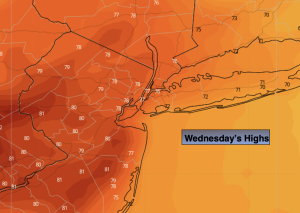
High pressure will move off the coast through Wednesday. This will result in a fine day with plenty of sun and seasonal temperatures. The average high is in the mid to upper 70s.
Weak low pressure will move into the region later Thursday. A mix of sun and clouds is expected. A few showers are possible Thursday night.
Abundant sunshine, warm readings and lower humidity is on the way for Friday as high pressure over the Great Lakes delivers a Northerly wind.
The weekend will be a 50/50 split. Saturday will be the better of the two days. A mix of sun and clouds is expected. Weak low pressure will move in from the West on Sunday with scattered showers. Both days will feature near seasonal temperatures.
Stay tuned.
Keep it here for a no nonsense, no hype forecast…
Tonight:
Mostly clear. Lows in the 60s in the City, the 50s inland. South winds less than 5 mph.
Wednesday:
Mostly sunny. Highs in the mid to upper 70s. Southwest winds at 5-10mph.
Thursday:
Partly sunny. Highs around 80º.
Friday:
Mostly sunny. Warm and less humid. Highs around 80º.
Saturday:
Partly sunny. Highs in the mid 70s.
Sunday:
Scattered showers. Highs in the mid 70s.