Synopsis:
High pressure will move over the East coast through Wednesday. This will keep the area mostly sunny and warm. The humidity will come down a notch.
Weak low pressure along a frontal boundary along the coast will cause showers on Thursday. This will occur mainly during the first half of the day. The sun will return during the mid-afternoon.
There will be a break in the action on Friday. Mainly sunny skies are expected with seasonal temperatures as high pressure works in from the West.
The weekend looks unsettled at this time with times of showers as a front gets hung up on or just off the coast. Saturday looks to be the drier half of the weekend.
Stay tuned.
Keep it here for a no nonsense, no hype forecast….
Tonight:
Partly cloudy. Lows in the lower 70s in the City, the 60s elsewhere. Light North wind.
Wednesday:
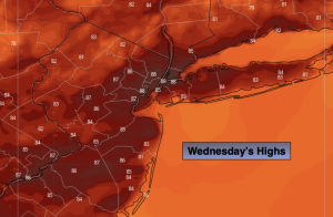
Mostly sunny. Highs in the mid to upper 80s. Northwest to Southwest winds at 5-10mph.
Thursday:
Showers likely through early afternoon. Some late day sun. Highs around 80º.
Friday:
Partly sunny. Highs in the lower 80s.
Saturday:
Sun and clouds. Few showers possible. Highs in the lower 80s.
Sunday:
Mostly cloudy. Showers likely. Highs around 80º.