Synopsis:
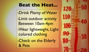
A heat wave will grip the region as a Bermuda high sets up shop. Temperatures Thursday and Friday will top the century mark in many areas. Many record will be broken on Thursday. The heat index will approach 110º. The heat will continue into the 4th of July weekend. This will be a prolonged heat wave. Please take into consideration the “Beat the Heat” tips above.
Isolated storms are possible Wednesday, Friday and Saturday afternoon.
Stay tuned.
Keep it here for a no nonsense, no hype forecast…
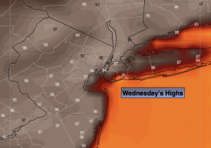
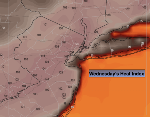
Wednesday:
Sunny. Hot and humid. Spotty PM storm. Highs in the mid to upper 90s. Heat index: 100º-105º. Southwest 8-15mph with gusts to 20mph.
Tonight:
Partly cloudy. Isolated storm possible early. Lows around 80º in the City, the 70s elsewhere. Southwest winds 5-10mph.
Thursday:
Hazy, hot and humid. Highs 99º-104º. Heat index near 110º.
Friday:
Hazy, hot and humid. Spotty PM storm. Highs 99º-104º. Heat index near 110º.
4th of July:
Hazy, hot and humid. Spotty PM storm. Highs 96º-101º. Heat index near 105º.
Sunday:
Sun and clouds. Still hot, but not as oppressive. Highs near 90º.