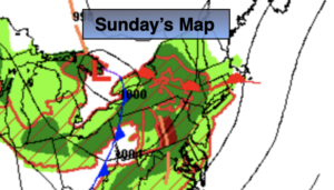
Synopsis:
Low pressure from the Great Lakes with its associated fronts will move toward the region. Sunday will feature more clouds with afternoon and evening showers. A thunderstorm is possible this evening. Readings will be near the seasonable averages of 73º.
Scattered showers and isolated storms will taper off early tonight. Skies will become partly cloudy late.
The beginning and mid portion of the workweek looks delightful with seasonable readings as high pressure dominates. Abundant sunshine is expected with seasonable readings. By Thursday, cooler air will work in with temperatures staying in the 60s.
Keep it here for a no hype, no nonsense forecast.
Sunday:
Mostly cloudy. Scattered afternoon showers and isolated evening storms. Highs in the lower 70s. Southwest winds at 8-12mph.
Tonight:
Scattered showers and isolated storms through early tonight. Clearing late. Lows in the lower 60s in the City, the 50s inland. West to Southwest winds 5-10mph.
Monday:
Mostly sunny. Highs in the mid 70s.
Tuesday:
Mostly sunny. Highs in the lower to mid 70s.
Wednesday:
Sunny. Highs around 70º.
Thursday:
Sunny. Highs in the mid to upper 60s.