Synopsis:
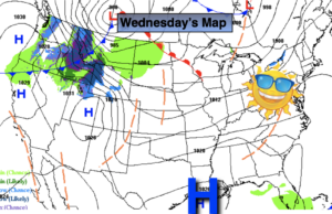
High pressure over the Southern states will continue to deliver non January-like conditions for our area. Mild readings are expected through the end of the week under a mix of clouds and sun. Readings will be well above the average high of 38º.
A cold front will approach the region on Friday. Ahead of it readings may approach 50º. A period of rain is likely with the front late Friday night into a part of Saturday. Low pressure will develop along the front, enhancing some of the rainfall. Any wet snow will be confined to areas well to the North and West (not a big deal). Sunday will be dry, but chilly with a gusty wind behind the departing and intensifying storm over Southeastern Canada.
There is still no significant snow in the foreseeable future.
Stay Tuned.
Keep it here for a no nonsense, no hype forecast.
Today:
Clouds and sun. Highs in the lower to mid 40s. West winds at 5-10mph.
Tonight:
Partly cloudy. Lows in the mid to upper 30s in the City, the 20s inland. Southwest winds less than 5mph.
Thursday:
Partly sunny. Mild. Highs in the mid to upper 40s.
Friday:
Partly sunny. Very mild. Highs around 50º.
Saturday:
Morning rain. Some late day sun. Highs in the mid 40s.
Sunday:
Sun and clouds. Highs around 40º.