Synopsis:
This 4th of July weekend will be memorable. Despite some morning clouds in spots today the sun will dominate and it will not be as hot or humid. A wind from the Northeast will be responsible for our more comfortable conditions. This will be short-lived as the wind will turn to the South on Sunday (around weak high pressure offshore). Conditions will once again become uncomfortable, but at the sun will dominate our sky. Please slather on the sunscreen! The UV index is a very high 9.
A potential heatwave will grip the area next week. Temperatures will flirt with 90º through Friday. Hazy sun is expected much of the time with moderate to high levels of humidity.
Stay Tuned.
Keep it here for a no nonsense, no hype forecast.
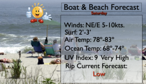
4th of July:
Any morning clouds will give way to sunny skies. Not as hot or humid. Highs in the lower to mid 80s. Northeast to East winds at 5-10mph.
Tonight:
Partly cloudy. Lows around 70º in the City, the 60s inland. South winds at 5mph.
Sunday:
Sunny. Highs in the upper 80s.
Monday:
Partly sunny. Hot. Highs around 90º.
Tuesday:
Hazy, hot and humid. Highs around 90º.
Wednesday:
Hazy, hot and humid. Highs around 90º.