Synopsis:
An upper level low over the Northeast will influence our weather for the next several days. For today this system will only result in isolated storms later this afternoon. It will be very warm, but the North wind has brought down much less humid air.
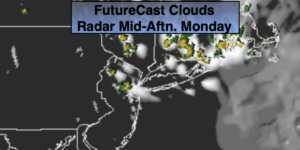
On Tuesday and Wednesday the low will have a greater affect on our area. More clouds are expected both days. This will result in lower temperatures (near or just below the average high of 83º). There is a greater threat of scattered showers, especially on Wednesday.
By Thursday, the system will dissipate and move off the coast. A brighter and warmer day is expected as we get into the month of July. Friday will be warmer and mostly sunny.
Stay Tuned.
Keep it here for a no nonsense, no hype forecast.
Today:
Mostly sunny, very warm and not as humid. Isolated afternoon storms. Most areas will remain dry. Highs in the upper 80s. North winds at 5-10mph.
Tonight:
Partly cloudy. Lows around 70º in urban areas, the 60s inland. Northwest winds at 5mph.
Tuesday:
Sun and clouds. Scattered showers. Cooler. Highs in the lower 80s.
Wednesday:
Clouds, some sun. A better chance of scattered showers. Highs in the lower 80s.
Thursday:
Mostly sunny. Warmer. Highs in the upper 80s.
Friday:
Mostly sunny. Highs in the upper 80s.