Synopsis:
A storm will move well offshore the Mid-Atlantic coast today. The storm will be far enough East to spare the region of significant precipitation but a spotty shower cannot be ruled through today. The morning fog will burn off and clouds will remain. The majority of the day will be dry.
Upper level energy will swing through the region tonight with scattered showers or rain or snow.
Sunday- Ground Hog Day, will be breezy with a mix of clouds and some sun. Readings this weekend will be above the average high of 39º.
A warmup is expected next week as strong high pressure settles off the Southeast coast. This will pump up Spring like readings through Wednesday. The threat of showers will increase by Wednesday. The 50s will be common through midweek. It won’t be feeling like February. The search for snow continues.
Stay Tuned.
Keep it here for a no nonsense, no hype forecast.
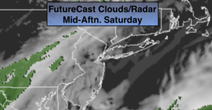
Saturday:
Areas of morning fog, otherwise mostly cloudy. Spotty showers are possible this afternoon. Highs in the lower to mid 40s. Northeast winds at 5mph.
Tonight:
Cloudy with scattered rain or snow showers. Lows in the 30s throughout. Light Northwest winds.
Sunday:
An early flurry or shower otherwise clouds will give way to some sun. Highs in the mid 40s.
Monday:
Partly sunny and much milder. Highs in the mid 50s.
Tuesday:
Mostly cloudy. Mild. Spotty showers are possible. Highs in the mid 50s.
Wednesday:
Mostly cloudy. Showers likely. Highs in the lower 50s.