Synopsis:.
Today will be bright & mild as high pressure moves over the Southeast.
An unsettled period is on the way for Friday though Saturday. Weak areas of low pressure will ride up the coast. There will be times of showers both days and also dry times. During this period it will be mild as a Southerly flow prevails.
A strengthening upper level low will move through the Tennessee Valley and then into the Mid-Atlantic Saturday night and Sunday morning. Most of the computer models develop a storm with this feature a bit too far North and East for any precipitation. The European is the outlier. This model slows the developing storm South of Long Island and throws back precipitation into our area Saturday night and Sunday morning. With this scenario snow showers are possible or even a period of light snow, especially North and East of the City. At this time, I’m including a chance of snow showers Saturday night.
Sunday will be windy behind the strengthening low in Eastern Canada. Clouds will dominate readings will be closer to the seasonal averages.
Stay Tuned.
Keep it here for a no hype, no nonsense forecast.
I would like to wish you all a very happy, prosperous and peaceful New Year! Thank you for trusting JMW with your forecast!
Today:
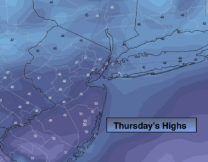
Mostly sunny. Milder. Highs in the upper 40s. West to Southwest winds at 5-10mph.
Tonight:
Thickening clouds. Light rain moves in from Southwest to Northeast within a few hours of midnight. Milder. Lows in the lower 40s in the City, the 30s North and West. Light Southwest winds.
Friday:
Morning light rain, otherwise cloudy with on and off showers. Mild. Highs in the lower 50s.
Saturday:
Morning rain. Remaining mostly cloudy during the afternoon. Mild. Highs around 50º.
Sunday:
Early snow showers possible, otherwise more clouds than sun, windy and colder. Highs in the upper 30s.
Monday:
Partly sunny. Highs around 40º.