Synopsis:
High pressure will dominate the Eastern one third of the nation into the weekend. A significant warm up is expected today and into the weekend-the last weekend of Summer as High pressure moves off the coast and the flow becomes Southwesterly. Autumn arrives on Monday (3:50AM EDT) but the conditions will still be Summer-like.
A cool front will move through Monday night uneventful, our search for significant rain continues. Temperatures will be more seasonal on Tuesday.
Stay Tuned.
Keep it here for a no nonsense, no hype forecast.
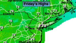
Today:
Sunny, milder. Highs in the upper 70s. West winds at 5-10mph.
Tonight:
Clear. Not as chilly as recent nights. Lows in the mid 60s in urban areas, the 50s inland. Light West winds.
Saturday:
Sunny. Warm. Highs in the lower to mid 80s.
Sunday:
Sunny. Warm. Highs in the mid 80s.
Monday:
Partly sunny. Warm. Highs in the mid 80s.
Tuesday:
Partly sunny. Cooler. Highs in the mid 70s.