Synopsis:
A Southwest flow will be with us today and continue through Thursday as high pressure settles over the Southeast. This will result in readings at or above 80º and more humid conditions. Scattered showers are possible this morning. There will be a dry times and the sun will shine for a time into the afternoon. A round of showers and storms is likely once again this evening and tonight as a disturbance works through.
A weak cool front will move through Thursday with spotty showers. A mix of clouds and sun is expected. This front will lower the humidity for Friday and into the Weekend. In fact, a string of beautiful days are anticipated into the weekend. Abundant sunshine, low humidity and warm temperatures are on the way.
Keep it here for a no nonsense, no hype forecast.
Today:
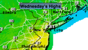
Scattered moving showers, otherwise a mix of clouds and sun. Warmer. Showers and storms are once again possible by evening. Highs around 80º. Southwest wind at 8-15mph.
Tonight:
Scattered showers and storms. Locally heavy rain in spots. Mild. Lows in the 60s. Southwest winds at 5-10mph.
Thursday:
Partly sunny. Warm and humid. Scattered showers possible just about any time. It will not be a washout. Highs in the mid 80s.
Friday:
Mostly sunny. Highs in the upper 70s.
Saturday:
Sunny. Highs in the upper 70s.
Sunday:
Mostly sunny. Highs around 80º.