Synopsis:
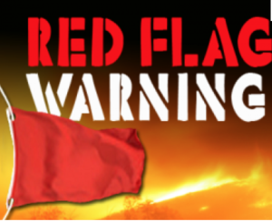
Gusty winds and very dry air will create conditions that may promote the rapid spread of wildfires. A Red Flag Warning remains in affect through early this evening for the area, excluding Long Island and Connecticut. Please use caution with flammables outdoors.
High pressure will take control from the North and West on Thursday resulting in a fine day.
A flow off the ocean and moisture working up from the South will cause showers to develop on Friday. It’ll be much cooler.
At this time the weekend looks to start off with clouds on Saturday morning with early showers. The clouds should break for some sun on Saturday. Sunday will feature plenty of sun. Both days will be mild with readings several degrees above the average high of 57º.
Keep it here for a no nonsense, no hype forecast.
Tonight:
Clear and chilly with diminishing winds. Lows around 40º in the City, the upper 20s and 30s elsewhere. West to Northwest winds diminishing to 5-10mph late.
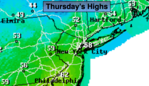
Thursday:
Mostly sunny. Highs in the upper 50s. West to Northwest winds at 10-15mph.
Friday:
Mostly cloudy, much cooler with scattered showers. Highs in the upper 40s.
Saturday:
Early morning showers and clouds will give way to some sun. Highs in the lower to mid 60s.
Sunday:
Partly sunny. Highs in the lower to mid 60s.
Monday:
Rain likely. Highs in the lower 60s.